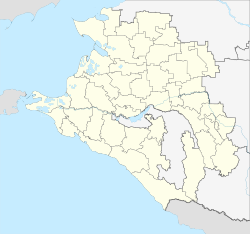
Varenikovskaya
| Staniza
Warenikowskaja
Варениковская
|
||||||||||||||||||||||||||||||||||
|
||||||||||||||||||||||||||||||||||
|
||||||||||||||||||||||||||||||||||
| List of large settlements in Russia | ||||||||||||||||||||||||||||||||||
Warenikowskaja ( Russian Варениковская ) is a Staniza in the Krasnodar region in Russia with 14,881 inhabitants (14 October 2010).
geography
The place is a good 100 km as the crow flies west of the regional administrative center of Krasnodar , on the left bank of the Kuban and at the foot of the extreme northwestern foothills of the Greater Caucasus .
Varenikovskaya belongs to the Krymsky district and is located about 35 km northwest of the administrative center of Krymsk . The settlement is the seat of the rural community Varenikovskoye selskoje posselenije, which also includes the village of Fadeevo (9 km southwest), the hamlets (chutor) Shkolny (9 km south) and Svet (7 km south-southeast) and the settlement at the Chekon railway station (8 km west) belong.
history
The Stanitsa was founded in 1862, towards the end of the Caucasus War 1817–1864, in place of a Russian defensive installation (" Redoute ") at a crossing point of the same name over the Kuban. She initially belonged to the (otdel) Temrjukski , later Tamanski, of Kuban Oblast . From 1940 to 1953 Varenikovskaya was the administrative seat of a raion named after her.
Population development
| year | Residents |
|---|---|
| 1890 | 6,407 |
| 1939 | 8,667 |
| 1959 | 10,561 |
| 1979 | 12,375 |
| 2002 | 14,225 |
| 2010 | 14,881 |
Note: from 1939 census data
traffic
Warenikowskaja has a train station at kilometer 34 of the Krymskaja - Kawkas line built on this section in 1944 . In Stanitsa the regional roads 03K-009 Krymsk - Dschiginka and 03K-010 from Anapa cross , which crosses the Kuban in a northerly direction and after a few kilometers reaches the 3K-002 Temryuk - Krasnodar - Kropotkin .
Web links
- Official website of the local government (Russian)
Individual evidence
- ↑ a b Itogi Vserossijskoj perepisi naselenija 2010 goda. Tom 1. Čislennostʹ i razmeščenie naselenija (Results of the All-Russian Census 2010. Volume 1. Number and distribution of the population). Tables 5 , pp. 12-209; 11 , pp. 312–979 (download from the website of the Federal Service for State Statistics of the Russian Federation)


