Rajevskaya
| Staniza
Rajewskaja
Раевская
|
||||||||||||||||||||||||||||||||||
|
||||||||||||||||||||||||||||||||||
|
||||||||||||||||||||||||||||||||||
| List of large settlements in Russia | ||||||||||||||||||||||||||||||||||
Rajewskaja ( Russian Раевская ) is a Staniza in the Krasnodar region in Russia with 10,020 inhabitants (14 October 2010).
geography
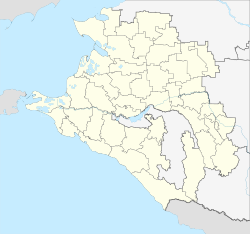
The place is a good 110 km as the crow flies west-southwest of the regional administrative center Krasnodar in the north-western, in the vicinity still a good 500 m high foothills of the Greater Caucasus , about 15 km away from the coast of the Black Sea .
Rajewskaja belongs to the Novorossiysk district and is located about 20 km northwest of the center of the city of Novorossiysk and 20 km east-southeast of Anapa . Stanitsa is the administrative seat of a "settlement district" (posselkowy okrug ) named after it within the city district.
history
Stanitsa was founded towards the end of the Caucasus War from 1817 to 1864 in 1862, not far from a Russian army fort of the same name that was built in 1839 and destroyed during the war . It was named in honor of General Nikolai Rajewski (1801–1843), not to be confused with his father , also a general, who bore the same name.
In 1921 the Stanitsa was renamed Krasno-Medvedovskaya and initially belonged to the Anapski rajon from 1923. The village soviet continued to carry the name Rajewski selsowet. Rayon from 1939 to back-to-Anapski belonged to the place to temporarily existing Werchnebakanski rayon. After 1945 the name Krasno-Medvedovskaya was completely out of use. In 1982, Rajewskaja was spun off from the Anapski rajon and subordinated to the Novorossiysk city soviet, from whose territory today's urban district emerged in 2006.
Population development
| year | Residents |
|---|---|
| 1979 | 5,998 |
| 2002 | 8,409 |
| 2010 | 10,020 |
Note: census data
traffic
Stanitsa is located on the 03K-028 regional road, which branches off the federal highway A290 (formerly M25) Novorossijsk - Port Kawkas northwest of Novorossiysk and leads from Rajewskaja in a northerly direction via Natuchajewskaja , where the A290 crosses again, and Gostagajewskaja to Jurowka . The nearest train stations are Tonnelnaya in Verkhnebakansky and Gaiduk near Novorossiysk on the Tichorezkaya - Krasnodar - Novorossiysk route.
Web links
Individual evidence
- ↑ a b Itogi Vserossijskoj perepisi naselenija 2010 goda. Tom 1. Čislennostʹ i razmeščenie naselenija (Results of the All-Russian Census 2010. Volume 1. Number and distribution of the population). Tables 5 , pp. 12-209; 11 , pp. 312–979 (download from the website of the Federal Service for State Statistics of the Russian Federation)

