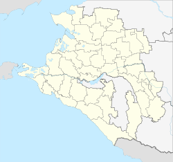
Dinskaya
| Staniza
Dinskaya
Динская
|
||||||||||||||||||||||||||||||||||||
|
||||||||||||||||||||||||||||||||||||
|
||||||||||||||||||||||||||||||||||||
| List of large settlements in Russia | ||||||||||||||||||||||||||||||||||||
Dinskaja ( Russian Динска́я ) is a stanitsa in the southern Russian region of Krasnodar with 34,848 inhabitants (as of October 14, 2010).
geography
Stanitsa is located in the central part of the Kuban region , about 30 km northeast of the regional capital Krasnodar on the Kotschety river. Dinskaya is the third largest stanitsa ( Cossack settlement ) in the region after Kanevskaya and Leningradskaya .
The Stanitsa Dinskaya is the administrative center of the Dinskaya Rajon (Dinskoi).
Kino 40 let pobedy ("40th anniversary of victory ")
history
The history of Stanitsa begins in 1794 when the first 40 Cossack settlements were founded in the Kuban area. The Zaporozhian Cossacks who settled here named the settlement south of today's Stanitsa after their place of origin Dinskoje on the Dnieper . The name Dinskoje is traced back to the Cossack name Din of the river Don , from which these Cossacks probably originally came.
In 1807 the settlement (" Kuren ") was moved to its present location; since 1842 it has been known as Staniza under its current name.
The economic importance of Stanitsa grew from 1888, when the railway line from the Tichorezkaya station of the main route of the North Caucasus Railway Rostov - Vladikavkas to Ekaterinodar (today's Krasnodar) was led through the place.
During the Second World War , the Stanitsa Dinskaya was occupied by the German Wehrmacht in August 1942 while it was advancing from the Don to the North Caucasus and was recaptured by the Red Army on February 11, 1943 .
Population development
| year | Residents |
|---|---|
| 1875 | 3,500 |
| 1900 | 8,000 |
| 1939 | 10.135 |
| 1959 | 11,180 |
| 1970 | 22,393 |
| 1979 | 26,518 |
| 1989 | 30,873 |
| 2002 | 34,132 |
| 2010 | 34,848 |
Note: from 1939 census data
Economy and Infrastructure
The Stanitsa is the center of an important agricultural area. There are a number of companies for the processing of agricultural products (sugar factory, canning factory, large confectionery " Juschnaja Zvezda " , large slaughterhouse ("meat combinat ") "Dinskoi" ).
Dinskaya is on the railway line from ( Volgograd -) Tichorezkaja – Krasnodar and further on to the Black Sea coast in the direction of Novorossiysk and Sochi (route km 642 from Volgograd). The M4 Moscow – Rostov – Novorossiysk highway runs northwest of the Stanitsa .
Individual evidence
- ↑ a b Itogi Vserossijskoj perepisi naselenija 2010 goda. Tom 1. Čislennostʹ i razmeščenie naselenija (Results of the All-Russian Census 2010. Volume 1. Number and distribution of the population). Tables 5 , pp. 12-209; 11 , pp. 312–979 (download from the website of the Federal Service for State Statistics of the Russian Federation)
Web links
- Dinskaya Raion Administration website (Russian, map, history, Stanitsa Administration )


