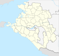
Starotitarovskaya
| Staniza
Starotitarovskaya
Старотитаровская
|
||||||||||||||||||||||||||||||||||||||||
|
||||||||||||||||||||||||||||||||||||||||
|
||||||||||||||||||||||||||||||||||||||||
| List of large settlements in Russia | ||||||||||||||||||||||||||||||||||||||||
Starotitarovskaya ( Russian Старотитаровская ) is a Staniza in the Krasnodar region in Russia with 12,164 inhabitants (14 October 2010).
geography
The place is located in the eastern part of the Taman peninsula about 150 km as the crow flies west-northwest of the regional administrative center of Krasnodar . The Starotitarowsky Liman extends on the eastern edge of the town , a few kilometers north of the Akhtanisowski Liman, both of which are fed by the left Kuban estuary of the Kasatschi Jerik and flow off to the Sea of Azov . The Kisiltaschski Liman, located south of the Stanitsa, is only separated from the Black Sea, which is just under 20 km away, by a narrow spit .
Starotitarovskaya belongs to the Temrjuksky Rajon and is located about 20 km west-southwest of its administrative center Temryuk . Stanitsa is the seat and the only locality of the rural community Starotitarowskoje selskoje posselenije.
history
Starotitarovskaya is one of the first 40 stanizi founded in 1794 by the Black Sea Cossacks in the Kuban area . It was initially named Titarowskoje as a spa settlement after an ataman Titarow. From the establishment of the Novotitarowskoje ("New Titarowskoje", today Staniza Novotitarowskaya) settlement just under 150 km east, a little north of today's Krasnodar, in 1810 the settlement was referred to as Starotitarowskoje ("Old Titarowskoje") from the time it was granted status a Staniza in 1848 under the current name. She initially belonged to the Temryuk Department (otdel) of Kuban Oblast .
Population development
| year | Residents |
|---|---|
| 1939 | 10,527 |
| 1959 | 9,776 |
| 1979 | 11,424 |
| 2002 | 12,193 |
| 2010 | 12.164 |
Note: census data
traffic
The federal highway A290 (formerly M25) runs southwest of the Stanitsa and leads from Novorossiysk via Anapa to Port Kawkas at the tip of the Taman Peninsula. On the southern outskirts of the village, the Starotitarowka railway station is at kilometer 86 on the Krymskaya - Port Kawkas line, which was built as far as Starotitarowskaya in 1944 and extended to Port Kawkas in 1954.
Web links
- Official website of the local government (Russian)
Individual evidence
- ↑ a b Itogi Vserossijskoj perepisi naselenija 2010 goda. Tom 1. Čislennostʹ i razmeščenie naselenija (Results of the All-Russian Census 2010. Volume 1. Number and distribution of the population). Tables 5 , pp. 12-209; 11 , pp. 312–979 (download from the website of the Federal Service for State Statistics of the Russian Federation)


