Novopokrovskaya
| Staniza
Novopokrovskaya
Новопокровская
|
||||||||||||||||||||||||||||||||
|
||||||||||||||||||||||||||||||||
|
||||||||||||||||||||||||||||||||
| List of large settlements in Russia | ||||||||||||||||||||||||||||||||
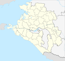
Novopokrowskaja ( Russian: Новопокро́вская ) is a staniza in the Krasnodar region ( Russia ) with 19,684 inhabitants (as of October 14, 2010).
geography
The place is located in the northeastern Kuban area in the foothills of the Caucasus , about 170 kilometers as the crow flies northeast of the regional administrative center Krasnodar , on the upper reaches of the Jeja River not far from its source. Southwest of the Staniza there is a 15 km² forest area, one of the few in the region.
Novopokrovskaya is the administrative center of the Novopokrovskaya Rajon of the same name . The rural settlement Novopokrowskaya includes the Stanitsa and the small settlements Gorky (7 km northeast), Jeja (9 km northwest) and Lesnitschestvo ("forestry", in the forest area 13 km southwest).
history
The place was founded in 1827 by resettlers from the Voronezh , Kursk and Kharkov Governments . At first it was known under the name Novo-Pokrowskaya, also Karassun : Pokrov denotes protection and intercession of the Holy Mother of God , one of the "great festivals" of the Russian Orthodox Church , novo- for new- was used to differentiate from the multitude of villages with the The name Pokrowskoje or Pokrowskaya prefixed, Karassun , today in the form of Korsun , is the name of a river that flows into the Jeja at the place. In 1848 the residents were raised to the status of Cossacks and the village became Stanitsa. As part of the administrative organization of the area, it was later assigned to the department (Otdel) Kawkasskaja of the Kuban Oblast .
In 1924 Novopokrovskaya became the administrative center of a newly created Rajon.
Population development
| year | Residents |
|---|---|
| 1897 | 9,136 |
| 1939 | 10,370 |
| 1959 | 11,361 |
| 1970 | 15,447 |
| 1979 | 17,333 |
| 1989 | 18,643 |
| 2002 | 19,095 |
| 2010 | 19,684 |
Note: census data
Economy and Infrastructure
In Novopokrowskaja, as the center of an agricultural area with the cultivation of grain, technical crops and fruits as well as cattle breeding, there are companies in the food industry and two factories for agricultural engineering and steam boilers ( Novopokrowskfermmasch and Kubanselmasch ).
Stanitsa is located on the Volgograd - Salsk - Tichorezkaja railway line (station name Jeja ; route km 488), which was opened in 1897 and is operated on this section by the North Caucasian Railway . A regional road runs along the railway line from Tichorezk on the M29 main road to Salsk in the neighboring Rostov region .
Personalities
- Irina Kowaljowa (* 1964 in Novopokrowskaja), poet and translator
- Arkadi Pervenzew (1911–1981), writer, Stalin Prize winner ; spent his youth in Novopokrovskaya
Individual evidence
- ↑ a b Itogi Vserossijskoj perepisi naselenija 2010 goda. Tom 1. Čislennostʹ i razmeščenie naselenija (Results of the All-Russian Census 2010. Volume 1. Number and distribution of the population). Tables 5 , pp. 12-209; 11 , pp. 312–979 (download from the website of the Federal Service for State Statistics of the Russian Federation)
- ↑ a b Novopokrovskaja on the website of the Geographical Institute of the RAN (Russian)
- ↑ Nowopokrowskfermmasch's website ( memento of the original from October 5, 2008 in the Internet Archive ) Info: The archive link was inserted automatically and has not yet been checked. Please check the original and archive link according to the instructions and then remove this notice. (Russian)
- ↑ website of Kubanselmasch (Russian)
Web links
- Novopokrovskaya Raion Administration website (Russian)


