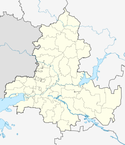
Salsk
| city
Salsk
Сальск
|
||||||||||||||||||||||||||||||||||||||||||
|
||||||||||||||||||||||||||||||||||||||||||
|
||||||||||||||||||||||||||||||||||||||||||
| List of cities in Russia | ||||||||||||||||||||||||||||||||||||||||||
Salsk ( Russian Сальск ) is a district town with 61,316 inhabitants (as of October 14, 2010) in Russia in the Rostov Oblast .
geography
Salsk is located on the Sredni Jegorlyk River in the south of Rostov Oblast, near the administrative borders of the Oblast to the Republic of Kalmykia and to the Stavropol and Krasnodar regions in the foothills of the Caucasus . The distance from Salsk to the regional capital Rostov-on-Don is around 180 km; the closest cities are Proletarsk (27 km northeast) and Gorodovikovsk (54 km southeast).
history
Salsk arose on the site of a village called Yudichev , which was founded around 1812 and was initially populated mainly by former serf farmers from northern Russian lands. In 1849 a church was built in the village for the first time and the village was renamed Voronzowo-Nikolajewskoje .
The actual city began to emerge in 1899, when a train station called Torgowaya and an associated settlement were built on the newly laid Tsaritsyn - Tichorezk line . In 1915 a branch line was moved from here to Bataisk , so that the station settlement became a junction. As a result, the population of the place increased noticeably and railway workshops and warehouses were built. In 1926 the settlement was granted city rights, at the same time it became a district town and was given its current name, after the river Sal.
In the 1930s, Salsk developed into an important regional center of the processing industry for agricultural products. In addition, businesses for the production of machines for the needs of agriculture were established here. This development continued after the Second World War , when Salsk was occupied by the German Wehrmacht from July 1941 to January 1943 and suffered severe damage.
Population development
| year | Residents | comment |
|---|---|---|
| 1926 | 6,902 | |
| 1939 | 11,365 | and 14,171 Voronzowo-Nikolajewskoje (incorporated in 1957) |
| 1959 | 35,964 | |
| 1970 | 50.197 | |
| 1979 | 57.003 | |
| 1989 | 61,088 | |
| 2002 | 61,775 | |
| 2010 | 61,316 |
Note: census data
economy
As the center of an agricultural district, Salsk has a large amount of food industry. There are also textile factories and companies in the building materials and furniture industries.
Education and culture
Salsk has a branch of the Rostov University of Economics, the city also has three theaters and, since 1977, its own small art museum.
sons and daughters of the town
- Natalja Alexandrovna Sabolotnaja (* 1985), Russian weightlifter
Individual evidence
- ↑ a b Itogi Vserossijskoj perepisi naselenija 2010 goda. Tom 1. Čislennostʹ i razmeščenie naselenija (Results of the All-Russian Census 2010. Volume 1. Number and distribution of the population). Tables 5 , pp. 12-209; 11 , pp. 312–979 (download from the website of the Federal Service for State Statistics of the Russian Federation)
Web links
- Official City and Rajon Administration Website (Russian)
- Salsk on mojgorod.ru (Russian)


