Bagayevskaya
| Staniza
Bagajewskaja
Багаевская
|
||||||||||||||||||||||||||||||||||
|
||||||||||||||||||||||||||||||||||
|
||||||||||||||||||||||||||||||||||
| List of large settlements in Russia | ||||||||||||||||||||||||||||||||||
Bagajewskaja ( Russian Багаевская ) is a Staniza in the Rostov Oblast ( Russia ) with 15,459 inhabitants (14 October 2010).
geography
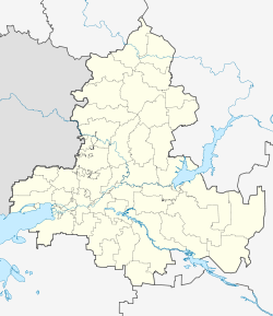
The place is on the left bank of the lower course of the Don a good 10 km above the confluence of the Manych and a good 50 km as the crow flies east of the administrative center of Rostov-on-Don .
Bagajewskaja is the administrative center of the Bagajewskaja Rajons of the same name . The rural community of the same name (Selskoje posselenije) includes the Stanitsa and the surrounding villages Beljanin (3 km southwest, 623 inhabitants), Fedulow (9 km southeast, 907), Golyje Bugry (6 km southwest, 26) and Krasnodonski (5 km south, 186) as well as the settlements Datschny (9 km southeast, 332) and Sadonski (5 km west on the other bank of the Don, 387). The rural community thus has 18,113 inhabitants (2010).
history
Stanitsa was first mentioned in 1672 in a report by the Cossack ataman Frola Minajew as Bagajewski Gorodok (about Bagajew town ), on the basis of which 1648 is considered the year of foundation. It developed quickly thanks to the fertile soils in the surrounding area. Initially located on the right bank of the Don, the Stanitsa Bagajewskaja was relocated to the more favorable current location in 1805 due to frequent flooding.
As part of an administrative reform, Bagajewskaja became the center of a Rajon in 1924, after its dissolution in 1929 again from 1935. During the Second World War , the Stanitsa was occupied by the German Wehrmacht from July 1942 to January 1943 .
In the 1950s it was given the status of an urban-type settlement under the name Bagajewski . In 1992 the urban settlement was converted back into a stanitsa, i.e. a rural settlement, since then again in the old name form.
Population development
| year | Residents |
|---|---|
| 1939 | 6,451 |
| 1959 | 9,118 |
| 1970 | 11,831 |
| 1979 | 12,741 |
| 1989 | 13,608 |
| 2002 | 15,275 |
| 2010 | 15,459 |
Note: census data
Economy and Infrastructure
In Bagajewskaja as the center of an agricultural area with predominantly the cultivation of vegetables and wheat as well as dairy farming there are companies in the food industry (juice and canning factory, dairy).
The Stanitsa is on a road that branches off a few kilometers south of the regional road that connects Rostov and Bataisk , some distance from the left bank of the Don, with Semikarakorsk . In Bagajewskaja, the side road crosses the Don, which is a good 300 meters wide there, via a car ferry, and continues to Novocherkassk , a good 30 kilometers away , with a connection to the M4 trunk road to Moscow . Novocherkassk is also the closest train station on the Moscow - Rostov route.
Individual evidence
- ↑ a b Itogi Vserossijskoj perepisi naselenija 2010 goda. Tom 1. Čislennostʹ i razmeščenie naselenija (Results of the All-Russian Census 2010. Volume 1. Number and distribution of the population). Tables 5 , pp. 12-209; 11 , pp. 312–979 (download from the website of the Federal Service for State Statistics of the Russian Federation)
- ↑ Changes in the administrative-territorial structure of the subjects of the Russian Federation on the official website of the 2002 census (Russian)
- ↑ Bagajewskaja on the website of the Geographical Institute of the RAN (still under Bagajewski ; Russian)
Web links
- “Bagayevsky District” from the Rostov Region Official Tourism Portal
- Bagajewskaja rural community on the Rajon Administration website (Russian)

