Morozovsk
| city
Morozovsk
Морозовск
|
||||||||||||||||||||||||||||||||||||||||||
|
||||||||||||||||||||||||||||||||||||||||||
|
||||||||||||||||||||||||||||||||||||||||||
| List of cities in Russia | ||||||||||||||||||||||||||||||||||||||||||
Morozovsk ( Russian Морозовск ) is a city in the Rostov Oblast ( Russia ) with 27,642 inhabitants (as of October 14, 2010).
geography
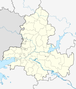
The city is located about 260 km northeast of the oblast capital Rostov-on-Don on the upper reaches of the Bystraja , a left tributary of the Seversky Donets .
Morozovsk is the administrative center of the raion of the same name .
The city is located on the Lichowskoi railway line ( Lichaya station ) - Volgograd . The line branching off here in the direction of Zimlyansk - Volgodonsk has been out of service since the 1990s. The M21 trunk road runs through the city from Volgograd to the Ukrainian border near Donetsk , which continues in Ukraine as the M 04 in the direction of Luhansk , Donetsk (Ukraine) and Dnipropetrovsk . The M21 is part of the European route 40 .
history
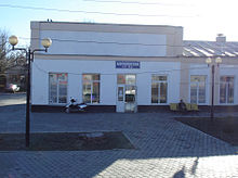
The place arose in the 1880s as the village of Morosow , named after the first settler. In 1900, the Morozovskaya railway station was opened on the new Lichaja- Tsaritsyno railway three kilometers from the village .
1910 was near the railway station, a Cossack stanitsa , after the German-born Ataman of the Orenburg Cossack Baron Fyodor of pigeon named (1857-1911) Taubejewskaja received. As part of the campaign to rename place names of German origin during the First World War , but relatively late, the Stanitsa was also given the name Morozovskaya after the train station on April 24, 1917 .
The village, station settlement and Stanitsa gradually grew together, so that in 1941 city rights were granted under the current name.
During the Second World War , Millerowo was occupied by the German Wehrmacht on July 15, 1942 and recaptured on January 5, 1943 by troops of the Southwest Front of the Red Army while advancing on Voroshilovgrad .
Population development
| year | Residents |
|---|---|
| 1939 | 21,662 |
| 1959 | 26,952 |
| 1970 | 27,024 |
| 1979 | 27,159 |
| 1989 | 27.004 |
| 2002 | 29,222 |
| 2010 | 27,642 |
Note: census data
economy
The most important company in the city is the agricultural machinery plant Morosowskselmasch . There are also companies in the food industry.
sons and daughters of the town
- Valery Alexandrovich Belikov (1925–1987), Army General
- Mychajlo Ishchenko (born 1950), handball player
Individual evidence
- ↑ a b Itogi Vserossijskoj perepisi naselenija 2010 goda. Tom 1. Čislennostʹ i razmeščenie naselenija (Results of the All-Russian Census 2010. Volume 1. Number and distribution of the population). Tables 5 , pp. 12-209; 11 , pp. 312–979 (download from the website of the Federal Service for State Statistics of the Russian Federation)
Web links
- Rajon and City Administration website (Russian)
- Unofficial city portal (Russian)
- Morozovsk on mojgorod.ru (Russian)


