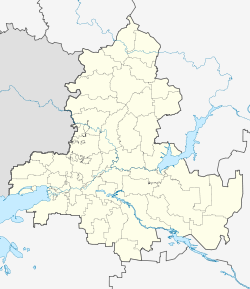
Pokrovskoye (Rostov)
| Village
Pokrovskoye
Покровское
|
||||||||||||||||||||||||||||||||||
|
||||||||||||||||||||||||||||||||||
|
||||||||||||||||||||||||||||||||||
| List of large settlements in Russia | ||||||||||||||||||||||||||||||||||
Pokrovskoje ( Russian Покро́вское ) is a village (selo) in Rostov Oblast in Russia with 12,369 inhabitants (as of October 14, 2010).
geography
The place is a good 60 km as the crow flies west-northwest of the administrative center of Rostov-on-Don and about 20 km north of the city of Taganrog . It is located on the left bank of the Mius , a good 15 km above its confluence with the Mius Liman of the Sea of Azov .
Pokrovskoye is the administrative center of the Rajons Neklinowski and seat and only town in the rural community of Pokrovskoye selskoje posselenije.
history
The place was founded in 1769 by Zaporozhian Cossacks . The name is derived from the Russian (or Church Slavonic ) short form for Pokrow Preswjatoi Bogorodozy , the holiday protection and intercession of the Holy Mother of God , one of the "great festivals" of the Russian Orthodox Church , to which the village church was initially consecrated.
Pokrovskoye has been the administrative seat of Neklinovsky rajon since 1936, and it has existed within its current borders since 1965. The Rajon is named after the originally more important villages Bolschaja Neklinowka and Malaja Neklinowka on the other bank of the Mius, also giving its name to the Neklinowka railway station in Pokrovskoje , after which the village experienced a significant boom after its opening in 1869.
Population development
| year | Residents |
|---|---|
| 1939 | 6,885 |
| 1959 | 8,138 |
| 1970 | 10,751 |
| 1979 | 11,631 |
| 1989 | 12,445 |
| 2002 | 12,595 |
| 2010 | 12,369 |
Note: census data
traffic
Pokrovskoye is located on the Moscow - Kharkiv - Rostov-on-Don railway line, which has been electrified on this section since 1961 ( Neklinowka station ; line kilometer 1256), which in the Soviet Union was part of the most important passenger connection between Moscow and the Caucasus and the Caucasian Black Sea coast . After the collapse of the Soviet Union , the route lost its importance to the eastern connection via Voronezh due to its route through Ukraine .
The regional road 60K-5 passes a few kilometers east of the village, which branches off the federal highway A280 (formerly M23) a good 10 km south-east near the village of Sambek and leads to the Ukrainian border (then on towards Charzysk ; part of the shortest connection between the Metropolises Rostov-on-Don and Donetsk ).
Web links
Individual evidence
- ↑ a b Itogi Vserossijskoj perepisi naselenija 2010 goda. Tom 1. Čislennostʹ i razmeščenie naselenija (Results of the All-Russian Census 2010. Volume 1. Number and distribution of the population). Tables 5 , pp. 12-209; 11 , pp. 312–979 (download from the website of the Federal Service for State Statistics of the Russian Federation)


