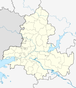
Aksai
| city
Aksai
Аксай
|
||||||||||||||||||||||||||||||||||||||||||||
|
||||||||||||||||||||||||||||||||||||||||||||
|
||||||||||||||||||||||||||||||||||||||||||||
| List of cities in Russia | ||||||||||||||||||||||||||||||||||||||||||||
Aksai ( Russian Акса́й ) is a city in the southern Russian Rostov Oblast and a satellite city of the Rostov-on-Don regional center . It is the capital of the Rajons of the same name and has 41,969 inhabitants (as of October 14, 2010).
geography
Aksai is located in the southeast of the Eastern European Plain , on the right bank of the Don near the mouth of the Aksai river that gives the place its name . The distance to the city center of Rostov-on-Don is 18 km in a southwest direction. Other nearby cities are Bataisk (17 km southwest of Aksai on the opposite bank of the Don) and Novocherkassk (24 km northeast).
history
The history of the place goes back to the second half of the 16th century when Cossacks founded the city in 1569. Initially, Aksai was a military base in one of the southern border areas of Russia and had to repel attacks several times, including by the Crimean Tatars . In the late 17th century, the place served as a guard post of Novocherkassk, the main base of the Don Cossack army, during the campaigns of Peter the Great against the Crimean Tatars . Aksai was still of military importance in the 19th century when a line of defense was positioned here during the Crimean War .
In the 1860s, the place was connected to the Russian railway network, which led to a growth in population. Agriculture has been practiced here since the village was founded due to the fertile soils and the warm climate by Russian standards .
Throughout its history Aksai was known by various names: the Ust-Aksaiskaja ( Усть-Аксайская ) Nischnije Rasdory ( Нижние Раздоры ) Kobjakowski ( Кобяковский ) Atamanski ( Атаманский ) or Nizhny ( Нижний ). From 1791 the settlement was named Aksaiskaja ( Акса́йская ). In 1957 it received its current name and city status.
Population development
| year | Residents |
|---|---|
| 1939 | 9,783 |
| 1959 | 15,518 |
| 1970 | 21,994 |
| 1979 | 29,987 |
| 1989 | 33,389 |
| 2002 | 38.012 |
| 2010 | 41,969 |
Note: census data
Economy and Transport
Because of its proximity to the metropolis of Rostov-on-Don, a large part of the Aksay population works there. Aksai has its own industrial plants only to a relatively small extent. These include a chemical plant, a glass factory, companies in the food industry, suppliers for agricultural machinery and a river shipyard.
The main transport links Aksai run through Rostov. The city has its own connection to the M4 trunk line and to a railway line of the North Caucasian Railway . Aksai also has a shipping pier on the Don.
Individual evidence
- ↑ a b Itogi Vserossijskoj perepisi naselenija 2010 goda. Tom 1. Čislennostʹ i razmeščenie naselenija (Results of the All-Russian Census 2010. Volume 1. Number and distribution of the population). Tables 5 , pp. 12-209; 11 , pp. 312–979 (download from the website of the Federal Service for State Statistics of the Russian Federation)
Web links
- Description of the city and raion on the official website of Rostov Oblast (Russian)
- Unofficial city portal (Russian)
- Aksai on mojgorod.ru (Russian)


