Kamensk-Shakhtinsky
| city
Kamensk-Shakhtinsky
Каменск-Шахтинский
|
||||||||||||||||||||||||||||||||||||||
|
||||||||||||||||||||||||||||||||||||||
|
||||||||||||||||||||||||||||||||||||||
| List of cities in Russia | ||||||||||||||||||||||||||||||||||||||
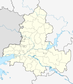
Kamensk-Schachtinski ( Russian Ка́менск-Ша́хтинский ) is a city in Russia . It is located in the Federal District of Southern Russia in the Rostov Oblast on the Seversky Donets River and has 95,296 inhabitants (as of October 14, 2010). The distance to the regional capital Rostov-on-Don is 145 kilometers.
history
The present city was founded in 1671 as a Cossack settlement of Kamenskaya , named after the nearby Kamenka River. Due to frequent fires, the settlement had to be relocated several times over the course of the next centuries, the last time in 1817 from the left to the right bank of the Donets. After the October Revolution , Kamenskaya belonged to the newly formed Donetsk Governorate of the Ukrainian SSR from 1920 ; in October 1925 the settlement came to the Russian SFSR as part of an administrative reform . On March 28, 1927, the settlement received town charter and was renamed Kamensk-Shakhtinsky two years later. The Schachtinski is derived from Schachta - Bergwerk, which can be traced back to several nearby hard coal mines. From 1954 to 1957 Kamensk was the administrative center of the oblast named after it . After its dissolution, the city was incorporated into the Rostov Oblast .
In 2004 the urban-type settlements of Lichowskoi (2002: 13,638 inhabitants) and Zavodskoi (8,962) were incorporated, so that the population of the city almost reached the 100,000 mark.
Population development
| year | Residents |
|---|---|
| 1897 | 12,190 |
| 1939 | 42,711 |
| 1959 | 57,525 |
| 1970 | 68,135 |
| 1979 | 71,598 |
| 1989 | 72,379 |
| 2002 | 75,632 |
| 2010 | 95,296 |
Note: census data
Economy and Infrastructure
Kamensk-Schachtinski is located in the Donets Basin , which is known as an important coal mining area. In the city itself there are several chemical companies, a mechanical engineering company and several food manufacturers.
The city is located on the Russian M4 trunk road , which runs from Moscow, 910 kilometers away, via Rostov to the Krasnodar region . There is also a direct rail link with Rostov.
education
- University Institute of the South Russian State Technical University
sons and daughters of the town
- Jossyp Kossonohow (1866–1922), physicist, geophysicist and meteorologist
- Yefim Shchadenko (1885–1951), Colonel General
- Cecilia Hansen (1897–1989), violin virtuoso
- Ivan Kochergin (1935-2015), wrestler
- Irina Rossichina (* 1975), sprinter
- Tony Igy (* 1985), music producer
- Anna Krylowa (* 1985), triple jumper
- Ulyana Donskowa (* 1992), gymnast and Olympic champion
Individual evidence
- ↑ a b Itogi Vserossijskoj perepisi naselenija 2010 goda. Tom 1. Čislennostʹ i razmeščenie naselenija (Results of the All-Russian Census 2010. Volume 1. Number and distribution of the population). Tables 5 , pp. 12-209; 11 , pp. 312–979 (download from the website of the Federal Service for State Statistics of the Russian Federation)
- ↑ Постановление Президиума ЦИК CCCP от 10.16.1925 "Об урегулировании границ Украинской Социалистической Советской Республики с Российской Социалистической Федеративной Советской Республикой и Белорусской Социалистической Советской Республикой "
- ↑ Щаденко Ефим Афанасьевич. knowbysight.info, accessed April 19, 2018 (Russian).
Web links
- Unofficial Portal (Russian only)
- History of the city (Russian only)
- Entry about Kamensk on mojgorod.ru


