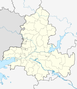
Belaya Kalitwa
| city
Belaya Kalitwa
Белая Калитва
|
||||||||||||||||||||||||||||||||||||||||||||
|
||||||||||||||||||||||||||||||||||||||||||||
|
||||||||||||||||||||||||||||||||||||||||||||
| List of cities in Russia | ||||||||||||||||||||||||||||||||||||||||||||
Belaja Kalitwa ( Russian Бе́лая Калитва́ ) is a Russian city with 43,651 inhabitants (as of October 14, 2010) in the Rostov region .
geography
Belaya Kalitwa is located on the eastern bank of the Seversky Donets River , at the mouth of the Kalitwa tributary . The distance to the regional capital Rostov-on-Don is almost 170 km, the closest city is Kamensk-Shakhtinsky, 50 km from Belaya Kalitwa . The surrounding landscape is characterized by the woodless steppe area of the Donets Basin.
history
The place was founded in 1703 as Cossack Stanitsa , which originally had the name Ust-Belokalitvenskaja , which translates as "(Stanitsa at the) mouth of the White Kalitwa" means. The river was called white due to the chalky rock on its banks. Until the 20th century, the place was predominantly inhabited by Don Cossacks.
With the development of industry in the first half of the 20th century, the place became a workers' settlement. On March 7, 1923, the place was the first administrative center of a Rajon , which initially existed until it was annexed to the Shakhty Rajon on August 20, 1931 and was spun off again on October 8, 1934. In the 1930s at the latest, the current name for the place became established, and on April 29, 1941 it received the status of an urban-type settlement .
During the attack on the Soviet Union in World War II, Belaya Kalitwa was occupied by German troops from July 20, 1942 to January 19, 1943. During this time, a forced labor camp was set up in the district of Forschtadt ( Форштадт , from German suburb , from 1912 at the newly built railway station south of the town on the other side of the Kalitwa and incorporated in 1925), in which the civilian population expelled from Stalingrad by German troops was set up for the Work assignment was selected. Anyone who was out of the question for work in Germany was “sent into the steppe” , formally on a hundred-kilometer march towards Kalatsch-on-Don , which, given the icy temperatures in the winter of 1942/43, amounted to a death sentence. For the time of the occupation, the spelling Forstadt , Forschstadt or Forchstadt can also be found for the place (for the actual “Forschtadt”, but also for the whole of Belaja Kalitwa) .
On August 29, 1958, Belaya Kalitwa received city status.
Population development
| year | Residents |
|---|---|
| 1939 | 8,198 |
| 1959 | 23,533 |
| 1970 | 30,857 |
| 1979 | 38.038 |
| 1989 | 47,803 |
| 2002 | 47,347 |
| 2010 | 43,651 |
Note: census data
Economy and Transport
The most important industrial company in Belaja Kalitwa is the aluminum metallurgy plant BKMPO . Further branches of industry are mechanical engineering, the food industry and coal mining in the nearby eastern part of the Donets Basin .
The M21 trunk road , which is the main road connection for Belaya Kalitwa, runs near the city . There is also a train station with train connections to Rostov-on-Don, among others.
sons and daughters of the town
- Alexander Kowaljow (* 1975), canoeist
- Roman Sarubin (* 1976), canoeist
- Roman Adamow (* 1982), football player
- Michail Tamonow (* 1992), canoeist
Individual evidence
- ↑ a b Itogi Vserossijskoj perepisi naselenija 2010 goda. Tom 1. Čislennostʹ i razmeščenie naselenija (Results of the All-Russian Census 2010. Volume 1. Number and distribution of the population). Tables 5 , pp. 12-209; 11 , pp. 312–979 (download from the website of the Federal Service for State Statistics of the Russian Federation)
- ↑ a b c History of the Rajons and its administration ( page no longer available , search in web archives ) Info: The link was automatically marked as defective. Please check the link according to the instructions and then remove this notice. on the website of the Belaya Kalitwa district administration (Russian)
- ↑ Local history on kalitva.ru (Russian)
- ↑ Etienne François, Hagen Schulze (ed.): German places of memory II . CH Beck, Munich 2001, ISBN 3-406-47223-0 , p. 341 .
- ^ A b Gert C. Lübbers: The 6th German army and the civilian population of Stalingrad . In: Vierteljahrshefte für Zeitgeschichte . Vol. 54, No. I , 2006, p. 87-123 ( online [PDF]).
- ↑ Erich v. Manstein: Lost victories . 18th edition. Bernard & Graefe, Bonn 2009, ISBN 978-3-7637-5253-9 , pp. 329 .
Web links
- Belaja Kalitwa on mojgorod.ru (Russian)


