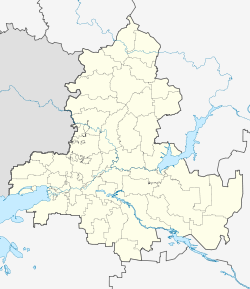
Orlowski (Rostov)
| settlement
Orlowski
Орловский
|
||||||||||||||||||||||||||||||
|
||||||||||||||||||||||||||||||
|
||||||||||||||||||||||||||||||
| List of large settlements in Russia | ||||||||||||||||||||||||||||||
Orlowski ( Russian Орло́вский ) is a settlement in the Rostov Oblast ( Russia ) with 20,002 inhabitants (as of October 14, 2010).
geography
The settlement is located in the southern Russian steppe landscape north of the Manytn lowlands , around 180 kilometers as the crow flies east-southeast of the Rostov-on-Don Oblast Administrative Center . It is located on the Dwoinaja, a left tributary of the Sal tributary, the Große Kuberle , which flows irregularly but is dammed into a series of ponds .
Orlowski is the administrative center of the Orlowski Rajon of the same name .
history
The first Russian settlements in the area previously predominantly inhabited by Kalmyks emerged in the 18th and 19th centuries. After 1899, the railway line from Tsaritsyn (now Volgograd) to Tikhoretskaya that the lower Volga to the North Caucasus connected with the station Dwoinaja had been opened, it came ukase of Tsar Nicholas II. To the settlement of Cossack families of upper Don in the still thin populated area.
On November 18, 1910, Stanitsa Orlovskaya was founded not far from the Dwoinaja train station . During the Russian civil war, Semyon Budjonny formed his cavalry division in this area in 1919 , which later became the legendary 1st Red Cavalry Army.
As part of an administrative reform, Orlovskaya was the administrative center of a Rajon in 1924, which was initially dissolved in 1926, but was restored on December 28, 1934. On August 1, 1938, the Orlovsk mechanical plant for the production of agricultural machinery was built on the basis of the MTS of the southeast Rostov Oblast at the Dvoinaja train station , since 1969 under the name Orlovskelmasch .
During the Second World War , Orlovskaya was captured by the German Wehrmacht at the end of July 1942 during the summer offensive (" Fall Blau ") , with the Stanitsa on the extreme left flank of Army Group A troops . On January 8-10, 1943, the 51st Army on the Red Army's southern front, advancing on Salsk , managed to recapture it.
On October 16, 1962, the growing place was given the status of an urban-type settlement in its current name . Orlowski was downgraded to a rural settlement in the 1990s.
Population development
| year | Residents |
|---|---|
| 1959 | 7,657 |
| 1970 | 12.101 |
| 1979 | 15,180 |
| 1989 | 17,597 |
| 2002 | 19,354 |
| 2010 | 20.002 |
Note: census data
Economy and Infrastructure
The largest company is the agricultural machinery factory Kormmasch , which emerged in 1992 from the former Orlowskselmasch . Otherwise Orlowski is characterized as the center of an agricultural area with predominantly cereal cultivation as well as cattle, pig, sheep and poultry farming by businesses in the food industry (flour, baked goods, dairy products); there are also companies in the construction industry. Thoroughbred and Budyonny horses are bred at the Donskoi stud in the village of Ostrowjanski des Rajons, 18 kilometers south-east .
Orlowski is located on the Volgograd - Timashevskaya - Krasnodar railway (station name Dwoinaja ; route km 320), which was electrified on this section in 2000 and throughout 2003 . A regional road runs along the railway line from Salsk towards Kotelnikowo in the neighboring Volgograd Oblast . From this a road branches off in Orlowski, which opens up the extreme southeast of Rostov Oblast north of the Manych and connects in the Republic of Kalmykia to the federal highway R216 in the direction of Elista and Astrakhan .
Individual evidence
- ↑ a b Itogi Vserossijskoj perepisi naselenija 2010 goda. Tom 1. Čislennostʹ i razmeščenie naselenija (Results of the All-Russian Census 2010. Volume 1. Number and distribution of the population). Tables 5 , pp. 12-209; 11 , pp. 312–979 (download from the website of the Federal Service for State Statistics of the Russian Federation)
- ↑ a b Orlowski on the website of the Geographical Institute of the RAN (Russian)
Web links
- Official website of the Raion Administration (Russian)

