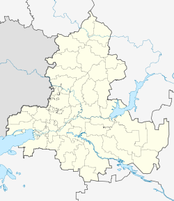
Egorlykskaya
| Staniza
Yegorlykskaya
Егорлыкская
|
||||||||||||||||||||||||||||||
|
||||||||||||||||||||||||||||||
|
||||||||||||||||||||||||||||||
| List of large settlements in Russia | ||||||||||||||||||||||||||||||
Yegorlykskaya ( Russian Егорлыкская ) is a Staniza in the Rostov Oblast ( Russia ) with 17,660 inhabitants (14 October 2010).
geography
The village is located in the northwestern foothills of the Caucasus , about 100 kilometers as the crow flies southeast of the administrative center of Rostov-on-Don on the Jegorlychok river (not to be confused with the Jegorlyk ) in the Jeja catchment area .
Jegorlykskaja is the administrative center of the Jegorlykskaja Rajons of the same name as well as a rural community which, in addition to Stanitsa, also includes the nine surrounding villages and hamlets Balabanow, Isobilny, Jutin, Koslowa Balka, Progress, Repjachowka, Ryasnoi, Serkalny and Taganrogski with a total of almost 2,500 inhabitants. Egorlykskaya is the most populous stanitsa in Rostov Oblast.
history
The stanitsa was begun in 1809, when at the request of Ataman Matvei Platov of and arrangement of the government Russian Empire Don Cossacks of from areas north of Don in the fact uninhabited area along the military route from Bataisk to the river Yegorlyk River and further into the northern Caucasus have been resettled.
In 1916 the Staniza railway connection, on January 18, 1935 it became the center of a Rajon as part of an administrative reform.
Population development
| year | Residents |
|---|---|
| 1897 | 5,154 |
| 1915 | 8,989 |
| 1939 | 7,264 |
| 1959 | 9,568 |
| 1970 | 12,068 |
| 1979 | 13,660 |
| 1989 | 15,805 |
| 2002 | 18.005 |
| 2010 | 17,660 |
Note:: except 1915 census data
Economy and Infrastructure
In Jegorlykskaja, as the center of an agricultural area with predominant cultivation of grain, oil fruits and vegetables as well as cattle farming, there are companies in the food and construction industries.
The Stanitsa lies on the railway line Bataisk - Salsk (station name Ataman ; route km 106) and the regional road R269, which connects Bataisk near Rostov with Stavropol . At Jegorlykskaja the R270 branches off to Salsk.
Sons and daughters of the place
- Fyodor Tokarew (1871–1968), weapons designer
Individual evidence
- ↑ a b Itogi Vserossijskoj perepisi naselenija 2010 goda. Tom 1. Čislennostʹ i razmeščenie naselenija (Results of the All-Russian Census 2010. Volume 1. Number and distribution of the population). Tables 5 , pp. 12-209; 11 , pp. 312–979 (download from the website of the Federal Service for State Statistics of the Russian Federation)
- ↑ a b Jegorlykskaja on the website of the Geographical Institute of the RAN (Russian)
Web links
- Rajon Administration website (Russian)

