Simovniki
| settlement
Simowniki
Зимовники
|
||||||||||||||||||||||||||||||||||||
|
||||||||||||||||||||||||||||||||||||
|
||||||||||||||||||||||||||||||||||||
| List of large settlements in Russia | ||||||||||||||||||||||||||||||||||||

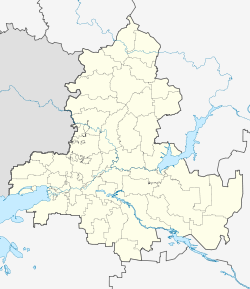
Simovniki ( Russian Зимовники ) is a settlement in the Rostov Oblast ( Russia ) with 18,070 inhabitants (as of October 14, 2010).
geography
The settlement is located in the southern Russian steppe area between the Don and Manych rivers , about 200 kilometers as the crow flies east of the Rostov Oblast Administrative Center . The Malaja Kuberle , a left tributary of the Sal, flows through the village .
Simovniki is the administrative center of the Simovniki Rajons of the same name . The rural community of the same name (Selskoje posselenije) includes the settlement as well as the surrounding villages of Donetsky, Ilyichev and Maikopski.
history
The place was built in 1898 in the place in which a previous temporary settlement, semi-nomadic living Kalmyk stayed farmers with their animals in winter, in connection with the construction of the railway line Tsaritsyn - Tikhoretskaya . After its inhabitants, the resulting train station was initially called Kalmyzkaja , the village of Kalmyzki (chutor) , in 1908 both were given the current name (from Russian simnik or simownik for a winter settlement of this type).
As part of an administrative reform in 1924 Simovniki became the center of a newly founded Rajon. During the Second World War, Simovniki was occupied by the German Wehrmacht as they advanced on Stalingrad and recaptured by the Red Army on January 8, 1943 .
In 1962, Simovniki received urban-type settlement status, but was downgraded to rural settlement again in 1992.
Population development
| year | Residents |
|---|---|
| 1939 | 9,439 |
| 1959 | 5,614 |
| 1970 | 15,322 |
| 1979 | 16,870 |
| 1989 | 16,934 |
| 2002 | 17,705 |
| 2010 | 18,070 |
Note: census data
Economy and Infrastructure
In Simowniki as the center of an agricultural area with predominantly grain cultivation (wheat, barley, oats, millet and maize, as well as sunflowers and vegetables) and sheep farming. There are a number of companies in the food industry.
The place is located on the Volgograd - Salsk - Tichorezkaya railway line, which was opened in 1899 and electrified on this section in 2001 , which is operated on this section by the North Caucasian Railway . A regional road runs along the railway line from Tichorezk on the M29 main road via Salsk to Kotelnikowo in the neighboring Volgograd Oblast . In Simovniki a street branches off from this to the Kalmyk capital Elista .
To the west of the settlement is a small airport for local connections (no ICAO code ; Russian code УРРФ / URRF ).
Individual evidence
- ↑ a b Itogi Vserossijskoj perepisi naselenija 2010 goda. Tom 1. Čislennostʹ i razmeščenie naselenija (Results of the All-Russian Census 2010. Volume 1. Number and distribution of the population). Tables 5 , pp. 12-209; 11 , pp. 312–979 (download from the website of the Federal Service for State Statistics of the Russian Federation)
- ↑ a b Simovniki on the website of the Geographical Institute of the RAN (Russian)

