
Scholokhovsky
| Urban-type settlement
Sholokhovsky
olokhovsky
|
||||||||||||||||||||||||||||||||||||||
|
||||||||||||||||||||||||||||||||||||||
|
||||||||||||||||||||||||||||||||||||||
.png)
.svg)

Scholochowski ( Russian Шо́лоховский ) is an urban-type settlement in the Rostov Oblast ( Russia ) with 8,306 inhabitants (as of October 14, 2010).
geography
The settlement is a good 150 km as the crow flies northeast of the Rostov-on-Don Oblast Administrative Center in the area of the watershed between the Bystraja , which flows 7 km to the east and the Kalitwa , which flows 10 km to the west , both left tributaries of the Seversky Donets .
Scholochowski belongs to the Belokalitvinski Rajons , is located a good 20 km northwest of its administrative seat Belaya Kalitwa and is the seat and only locality of the municipality Scholochowskoje gorodskoje posselenije.
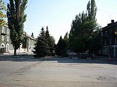
1950s residential building in the town center
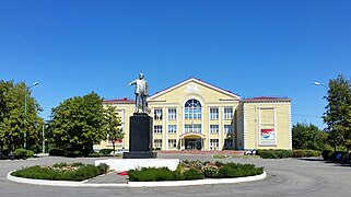
Culture house

hospital

Sports complex
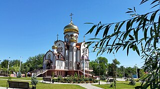
Viktor von Nicomedia Church (consecrated 2013)


history
After the discovery of a coal deposit in the field, there were 1950 plans, there manholes to sink and establish a workers' settlement. These were implemented from 1952. The first buildings in the village, initially Maiski (derived from the name of the month) or, unofficially, Scholochowka , were built in 1953. Workers from Bulgaria were also involved in the construction of the settlement - initially in the “Stalinist style” , which is now remembered by a Dimitrov bust and street . On August 4, 1955, the place received the status of an urban-type settlement under the current name of the geologist under whose direction the coal deposit was discovered. Three mines started operations between 1958 and 1964.
From the 1990s, coal mining in the area experienced a decline, causing the population to decline significantly; the last mine near Scholochowski closed in 2002.
Population development
| year | Residents |
|---|---|
| 1959 | 8,137 |
| 1970 | 13,983 |
| 1979 | 13,724 |
| 1989 | 13,328 |
| 2002 | 10,077 |
| 2010 | 8,306 |
Note: census data
traffic
The federal highway A260 (part of European route 40 ) runs south of the settlement from the Ukrainian border (from Donetsk - Luhansk ) via Kamensk-Shakhtinsky to Volgograd .
The next train station is Grachi , about 10 km southwest, at 71 km of the line from Lichaya (in Lichowskoi, now part of Kamensk-Shakhtinsky) to Volgograd, which opened in 1900. A freight connection line leading from there to the mines around Scholochowski was shut down and dismantled for the last few kilometers from a briquette factory that was still in operation 5 km southwest of the settlement after mining was stopped.
Sons and daughters of the place
- Tatjana Kotowa (* 1985), beauty queen (Miss Russia 2006) and singer
Individual evidence
- ↑ a b Itogi Vserossijskoj perepisi naselenija 2010 goda. Tom 1. Čislennostʹ i razmeščenie naselenija (Results of the All-Russian Census 2010. Volume 1. Number and distribution of the population). Tables 5 , pp. 12-209; 11 , pp. 312–979 (download from the website of the Federal Service for State Statistics of the Russian Federation)
Web links
| Cities |
Aksai R | Azov S / R | Bataisk S | Belaya Kalitwa R | Donetsk S | Gukowo S | Kamensk-Shakhtinsky S | Konstantinovsk R | Krasny Sulin R | Millerowo R | Morozovsk R | Novoshakhtinsk S | Novocherkassk S | Proletarsk R | Rostov-on-Don S | Salsk R | Schachty S | Semikarakorsk R | Sernograd R | Swerewo S | Taganrog S | Volgodonsk S | Zimlyansk R |
|
| Urban-type settlements |
Gluboki R | Gorny | Kamenolomni R | Schirnow | Scholochowski | Uglerodowski | Ust-Donetsky R |
|
| Other Rajon centers |
Bagayevskaya | Bokovskaya | Bolshaya Martynovka | Dubovskoye | Egorlykskaya | Kagalnitskaya | Kazanskaya | Kaschary | Kuibyshevo | Matveev Kurgan | Milyutinskaya | Oblivskaya | Orlowski | Pestschanokopskoye | Pokrovskoye | Remontnoye | Rodionovo-Nesvetaiskaya | Romanovskaya | Sawetnoye | Simovniki | Sovetskaya | Tarassowski | Tatsinskaya | Tschaltyr | Chertkovo | Vessyoly | Vyoschenskaya | Zelina |