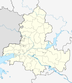
Matveyev Kurgan
| settlement
Matveev Kurgan
Матвеев Курган
|
||||||||||||||||||||||||||||||||||
|
||||||||||||||||||||||||||||||||||
|
||||||||||||||||||||||||||||||||||
| List of large settlements in Russia | ||||||||||||||||||||||||||||||||||
Matwejew Kurgan ( Russian Матвеев Курган ; also in the spelling Matvejew-Kurgan, Матвеев-Курган ) is a settlement (possjolok) in the Rostov Oblast in Russia with 15,590 inhabitants (as of October 14, 2010).
geography
The place is about 75 km as the crow flies north-west of the administrative center of Rostov-on-Don on the left bank of the Mius , about 20 km from the state border with Ukraine .
Matwejew Kurgan is the management center Rajons Matwejewo-Kurganski and seat the rural community posselenije Matwejewo-Kurganskoje selskoje, (km 24 east) to which also the villages Kamyschowka, Marjewka (21 km to the east), Nowoandrianowka (13 km to the east), Petrowka (18 km east-northeast ) and Sokolowka (23 km east), the settlements Krasny Bumaschnik (5 km west) and Suchoretschenski (4 km south) and the hamlets (chutor) Daraganow (7 km west), Kolesnikowo (3 km south-south-east), Samoilowo (15 km west-south-west ) and Starorotowka (3 km north) belong.
history
The place was founded in 1780 by the ataman of the Don Cossacks Alexei Ilowaiski († 1797). The importance of the village only grew after the Kharkov - Taganrog railway line of the then Kursk-Kharkov-Azov Railway, which began operating on the section on December 23, 1869, was passed.
In 1923 Matveev Kurgan became the administrative center of a Rajon. During the Second World War , the place was occupied by the German Wehrmacht from October 17, 1941 to February 17, 1943 . After the reconquest by the Red Army , the front continued for about half a year in the immediate vicinity of the place, as the Wehrmacht had built strong defensive positions along the Mius, which could only be overcome in July to August 1943 as part of the Donez-Mius offensive .
From 1962 to 1993 Matveev Kurgan had the status of an urban-type settlement .
Population development
| year | Residents |
|---|---|
| 1872 | 682 |
| 1939 | 5,812 |
| 1959 | 6,735 |
| 1970 | 11,318 |
| 1979 | 12,512 |
| 1989 | 13,892 |
| 2002 | 14,364 |
| 2010 | 15,590 |
Note: from 1939 census data
traffic
Matveyev Kurgan is located on the since 1961 on this section electrified railway Moscow - Kharkiv - Rostov-on-Don (kilometer 1,237), which in the Soviet Union the most important link in the movement of persons between Moscow and the part of the Caucasus and the Caucasian Black Sea coast was. After the collapse of the Soviet Union , the route lost its importance to the eastern connection via Voronezh due to its route through Ukraine .
On the eastern edge of the village, the regional road 60K-5 passes, which branches off the federal highway A280 (formerly M23) east of Taganrog and leads to the Ukrainian border (then further towards Kharzysk ; part of the shortest connection between the megacities of Rostov-on-Don and Donetsk ).
Sons and daughters of the place
- Oleksandr Onishchenko (* 1969), Ukrainian entrepreneur, equestrian and sports official
Web links
Individual evidence
- ↑ a b Itogi Vserossijskoj perepisi naselenija 2010 goda. Tom 1. Čislennostʹ i razmeščenie naselenija (Results of the All-Russian Census 2010. Volume 1. Number and distribution of the population). Tables 5 , pp. 12-209; 11 , pp. 312–979 (download from the website of the Federal Service for State Statistics of the Russian Federation)


