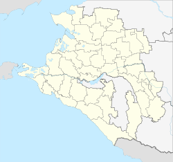
Staromyshastovskaya
| Staniza
Staromyschastowskaja
Старомышастовская
|
||||||||||||||||||||||||||||||||||||||
|
||||||||||||||||||||||||||||||||||||||
|
||||||||||||||||||||||||||||||||||||||
| List of large settlements in Russia | ||||||||||||||||||||||||||||||||||||||
Staromyschastowskaja ( Russian Старомышастовская ) is a Staniza in the Krasnodar region in Russia with 10,610 inhabitants (14 October 2010).
geography
The place is about 35 km as the crow flies north-northeast of the regional administrative center Krasnodar on the Kotschety , a good 10 km above its confluence at Medvedovskaya in the Kirpili , a tributary of the Sea of Azov .
Staromyshastovskaya belongs to the Dinskoi Raion and is located about 20 km northwest of its administrative center Dinskaya . The Stanitsa is the seat of the rural community Staromyschastowskoje selskoje posselenije, which also includes the hamlets (chutor) Gorlachivka (2 km northeast), Novy (5 km southeast) and Vostochny (5 km northeast).
history
In 1794 the Cossacks resettled from the Zaporozhye Sichastovskaya founded the spa settlement of Myshastovskaya , about 40 km southwest, closer to the Kuban in the place of today's Stanitsa Novomyshastovskaya . In 1810 at the latest it was moved to its current location; nevertheless, 1794 is mostly considered the year of foundation. In 1823 the original location was settled again and was given the name Novomyshastovskoye ("New Myshastovskoye") to distinguish it, while the main settlement, although it emerged later, was now called Staromyshastovskoye ("Old Myshastovskoye") after the status of a Staniza was granted in 1842 under today's name form.
Population development
| year | Residents |
|---|---|
| 1939 | 7,678 |
| 1959 | 7,526 |
| 1979 | 9,445 |
| 2002 | 10,489 |
| 2010 | 10,610 |
Note: census data
traffic
To the west of Staromyschastowskaja, the Myshastovka station is located at kilometer 37 (from Krasnodar, corresponding to kilometer 1587 from Moscow ) of the Bataisk - Krasnodar railway line ( Rostov-on-Don -) electrified since 1972 , which originally started on this section in 1914 as part of the Krasnodar connection (then Ekaterinodar ) - Primorsko-Akhtarsk ( Akhtari station ) went into operation and was expanded into the main line from the 1960s.
The regional road 03K-001 runs along the railway line from Krasnodar to Yeisk (formerly R268 to Bataisk). From there, the 03N-190, a cross connection to the federal trunk road M4 Moscow - Krasnodar - Novorossiysk near the district center of Dinskaya , runs through Stanitsa .
Web links
- Official website of the local government (Russian)
Individual evidence
- ↑ a b Itogi Vserossijskoj perepisi naselenija 2010 goda. Tom 1. Čislennostʹ i razmeščenie naselenija (Results of the All-Russian Census 2010. Volume 1. Number and distribution of the population). Tables 5 , pp. 12-209; 11 , pp. 312–979 (download from the website of the Federal Service for State Statistics of the Russian Federation)


