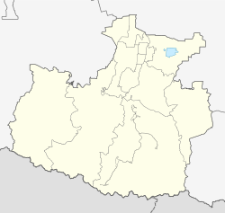
Karachayevsk
city
|
||||||||||||||||||||||||||||||||||||||||
|
||||||||||||||||||||||||||||||||||||||||
|
||||||||||||||||||||||||||||||||||||||||
| List of cities in Russia | ||||||||||||||||||||||||||||||||||||||||
Karachayevsk ( Russian Карача́евск , Karachay - Balkar Къарачай шахар ) is a small town in the North Caucasian republic of Karachay-Cherkessia in Russia with 21,483 inhabitants (as of October 14, 2010).
geography
The city is located in the northern part of the Greater Caucasus about 60 km southeast of the republic capital Cherkessk at the confluence of the Teberda in the Kuban .
Karachayevsk is administratively directly subordinate to the republic and at the same time the administrative center of the raion of the same name . The city itself is directly subordinate to the city of Teberda (7,301 inhabitants), the urban-type settlements Ordzhonikidsewski (2,934 inhabitants), Dombai (385 inhabitants) and Elbrusski (215 inhabitants) as well as villages with a total of 3,571 inhabitants, so that the total number of inhabitants of the administrative unit city of Karachayevsk 34,083 (calculation 2009).
The city is the end of the A157 trunk road .
history
Founded as the village of Georgievskoye , the place was renamed Mikoyan-Shachar in 1926 after the party official and politician Anastas Mikojan . In 1929 the city charter was granted under this name.
In 1944 it was renamed Kluchori again (after the Kluchori pass over the main Caucasus ridge) with the simultaneous connection of the city and the surrounding area to the Georgian SSR in connection with the dissolution of the Autonomous Republic and the deportation of the Karachay population.
In 1957 it was returned to the Russian SFSR and the city got its current name after the Karachay people.
Population development
| year | Residents |
|---|---|
| 1939 | 5,919 |
| 1959 | 7.169 |
| 1970 | 14,762 |
| 1979 | 16,873 |
| 1989 | 21,582 |
| 2002 | 22,113 |
| 2010 | 21,483 |
Note: census data
Culture and sights
In the area there are several churches and monasteries from the 10th to 19th centuries (on Mount Shoana , in the village of Nizhnyaya Teberda ) as well as in the village of Chumara a 25-hectare castle wall (Gorodishche) from the 8th to 10th centuries.
The Ordzhonikidsewski settlement belonging to Karachayevsk is home to the Memorial Museum of the Defenders of the Caucasus Passes , which focuses on the Great Patriotic War .
economy
In Karachayevsk there are electrical engineering, construction and food industries.
sons and daughters of the town
- Aleksandre Tschivadze (* 1955), Soviet-Georgian football player and coach
- Novruz Temrezov (* 1981), Russian or Azerbaijani wrestler
Web links
- City administration website (Russian)
- Karachayevsk on mojgorod.ru (Russian)
Individual evidence
- ↑ a b Itogi Vserossijskoj perepisi naselenija 2010 goda. Tom 1. Čislennostʹ i razmeščenie naselenija (Results of the All-Russian Census 2010. Volume 1. Number and distribution of the population). Tables 5 , pp. 12-209; 11 , pp. 312–979 (download from the website of the Federal Service for State Statistics of the Russian Federation)


