Utschkeken
Village
|
||||||||||||||||||||||||||||
|
||||||||||||||||||||||||||||
|
||||||||||||||||||||||||||||
| List of large settlements in Russia | ||||||||||||||||||||||||||||
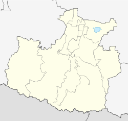
Utschkeken ( Russian Учкекен , Karachay - Balkar Ючкёкен ) is a village (selo) in the Republic of Karachay-Cherkessia ( Russia ) with 16,512 inhabitants (as of October 14, 2010).
geography
The village is located on the northern edge of the Greater Caucasus , about 50 km as the crow flies southwest of the republic capital Cherkessk and 16 km west of the spa town of Kislovodsk, which is already in the neighboring Stavropol region . The mountains in the vicinity of the almost 1000 m high place rise to about 1500 m . Utschkeken extends in the valley of the Eschkakon, which flows into the right Kuma tributary Podkumok at the lower edge of the village .
Uchkeken is the administrative center of the Rajons Malokaratschajewski . The place is mainly inhabited by Karachay people.
history
The village was founded in 1922. When the Karachay-Cherkess Autonomous Region (predecessor of today's republic) was re-established in 1943 , it became the administrative center of a Rajon.
Population development
| year | Residents |
|---|---|
| 1959 | 4,997 |
| 1970 | 9.110 |
| 1979 | 11,268 |
| 1989 | 13,872 |
| 2002 | 15.052 |
| 2010 | 16,512 |
Note: census data
education
There are branches of the Southern Federal University of Rostov-on-Don and the State Linguistic University of Pyatigorsk in Uchkeken .
Economy and Infrastructure
In the agricultural area around Utschkeken, wheat, potatoes and fodder crops are grown; cattle, sheep and horses are raised ( Karachayevsky stud ). In the village there are light and food industries as well as the construction industry.
The nearest train station as the end of a branch line from Mineralnye Vody is in Kislovodsk. The A157 Karachayevsk - Pyatigorsk road runs through the village .
Individual evidence
- ↑ a b Itogi Vserossijskoj perepisi naselenija 2010 goda. Tom 1. Čislennostʹ i razmeščenie naselenija (Results of the All-Russian Census 2010. Volume 1. Number and distribution of the population). Tables 5 , pp. 12-209; 11 , pp. 312–979 (download from the website of the Federal Service for State Statistics of the Russian Federation)
- ↑ a b Utschkeken on the website of the Geographical Institute of the RAN (Russian)

