Tegal
| Tegal | ||
|---|---|---|
|
|
||
| Coordinates | 6 ° 51 '57 " S , 109 ° 8' 19" E | |
| Symbols | ||
|
||
| Basic data | ||
| Country | Indonesia | |
|
Geographical unit |
Java | |
| province | Jawa Tengah | |
| ISO 3166-2 | ID-JT | |
| height | 5 m | |
| surface | 39.7 km² | |
| Residents | 247,076 (2006) | |
| density | 6,226.7 Ew. / km² | |
| Website | www.tegalkota.go.id (Indonesian) | |
|
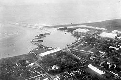
View of the Java Sea
|
||
Tegal is an Indonesian city with about 250,000 inhabitants. It is located on the north coast of the island of Java .
geography
As a city ( Kota ), Tegal is administratively directly subordinate to the province of Central Java ( Jawa Tengah ) and is not part of a government district ( Kabupaten ).
Tegal is located on the Java Sea , about 250 kilometers east of the capital Jakarta . It is a further 140 kilometers to the east to the provincial capital Semarang .
history
The city emerged from a village called Tetegual . In the middle of the 16th century the area came under the rule of the Kingdom of Pajang and later the Dutch in the colony of the Dutch East Indies . In the 1920s there was a center of the Communist Party of Indonesia here .
Until the middle of the 20th century, sugar was grown in the vicinity of the city and shipped in the port.
sons and daughters of the town
- Hariamanto Kartono (* 1954), badminton player
- Hadibowo (1958-2011), former badminton player
- Simon Santoso (* 1985), former badminton player
Web links
Individual evidence
- ↑ List of the administrative units of Indonesia down to the Desas 2010 ( Memento from April 6, 2013 in the Internet Archive ) (English; PDF; 5.9 MB)


