Tenosique de Pino Suarez
| Tenosique de Pino Suarez | ||
|---|---|---|
|
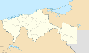
Coordinates: 17 ° 29 ′ N , 91 ° 25 ′ W Tenosique de Pino Suarez on the map of Tabasco
|
||
| Basic data | ||
| Country | Mexico | |
| State | Tabasco | |
| Municipio | Tenosique | |
| Residents | 32,579 (2010) | |
| Detailed data | ||
| height | 20 m | |
| Post Code | 86900 | |
| prefix | 934 | |
| Website | ||
| Tenosique - Iglesia de San Román | ||
Tenosique de Pino Suárez (short Tenosique ) is a city with about 35,000 inhabitants in the southeast of the Mexican state of Tabasco . It is the administrative seat (cabecera) of the Municipio Tenosique .
location
Tenosique is located on a loop of the Usumacinta River about 213 km (driving distance) southeast of the city of Villahermosa at an altitude of about 20 m . The archaeological excavation site of Pomoná is about 16 km to the west. The climate is humid and humid; Rain (approx. 2125 mm / year) falls mainly in the summer months.
population
| year | 2000 | 2005 | 2010 |
| Residents | 30,042 | 31,392 | 32,579 |
The population is originally of Maya origin. On the other hand, many new settlers from other regions of Mexico also immigrated in the second half of the 20th century. Colloquial languages are mainly Nahuatl , Maya and Spanish .
economy
The region around Tenosique is largely agricultural; Corn , sugar cane and beans are grown . Livestock breeding also plays an important role.
history
Before the conquest , only members of different Maya tribes lived in the area around today's city. There was one larger settlement that Hernán Cortés describes as burned and abandoned when he traveled to Honduras in 1525. In 1537 the officer Francisco Gil from the army of Pedro de Alvarados founded a place called San Pedro Tanoche , which was soon abandoned. The present-day city did not emerge until the first half of the 19th century, but only grew to a significant size after the construction of a road and a railway line in the 1930s and 1940s, which was further facilitated by immigration.
Attractions
- The streets in the center are mostly laid out at right angles; at the central Plaza Mayor are the church and town hall.
- The two-tower Iglesia de San Román , a three-aisled building from the mid-20th century, is - although there are other, but lesser-known candidates - probably dedicated to St. Consecrated to Romanus of Antioch .
Surroundings
- The archaeological site of Pomoná is about 15 km to the west. Other small Mayan sites ( Panhalé , Chiniquijá and Santa Elena ) are approx. 30 to 50 km away.
Fiesta
The Carnival of Tenosique, which reaches its climax with the Danza del Pochó , is known beyond the region .
Web links
- Municipio Tenosique - Photos + Info (Spanish)
- Municipio Tenosique - Photos + Info (Spanish)
- Tenosique, tourism site - photos + information (Spanish)


