Terumbu Mantanani
| Mariveles Reef (Terumbu Mantanani) |
||
|---|---|---|
| Landsat- 7 image (October 1999) | ||
| Waters | South China Sea | |
| archipelago | Spratly Islands | |
| Geographical location | 7 ° 59 ′ N , 113 ° 50 ′ E | |
|
|
||
| Number of islands | 1 Cay | |
| length | 10.2 km | |
| width | 2.8 km | |
| Land area | ||
| total area | 17.5 km² | |
| Residents | 20th | |
The Mariveles Reef or ( Malay ) Terumbu Mantanani is an atoll of the Spratly Islands .
geography
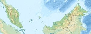
The atoll protrudes around two meters from the water at high tide. It is located around 313 kilometers off the northwest coast of the state of Sabah near Kota Kinabalu and is claimed by Malaysia .
The atoll extends for 10.2 km from northwest to southeast, and is a maximum of 2.8 km wide in the north-western part. The total area is around 17.5 km². The reef rim encloses a larger lagunda in the northwest and a smaller one in the southeast. In between is a cay .
The island in the Spratly conflict
The Mariveles Reef is also claimed by several nations within the Spratly Islands conflict .
Malaysia refers to the continental shelf argument (Shelf of Sabah and Sarawak) or the 200-mile zone in its legal claims. It claims a total of 12 southern Spratly Islands and currently holds six islands or reefs ( Ardasier Reef , Dallas Reef , Erica Reef , Investigator Shoal, Mariveles Reef and Swallow Reef ). The legal claims are well secured by the Convention on the Law of the Sea . Malaysia has a modernly equipped navy (10 missile frigates ).
Military personnel from the Malaysian Navy are stationed on Mariveles Reef .
Individual evidence
- ↑ a b Malaysia’s Sovereignty Claim Based on Continental Reef Principle ; Accessed January 16, 2012
- ^ The race of the Southeast Asian states for the Spratly Islands ; Accessed January 16, 2012
Web links
- List of the names of all Spratly features known to be occupied and / or above water at low tide ; Accessed January 16, 2012
- Aerial views of the Malaysian military bases on the islands of the Spratly ; Accessed January 19, 2012
Remarks
- ↑ The English names are Mariveles Reef and Mantanani Reef .

