Teucheler Heide
Coordinates: 51 ° 54 ′ 5 " N , 12 ° 39 ′ 34" E
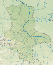
The Teucheler Heide is a heath in Fläming . It is located in the north of Lutherstadt Wittenberg in Saxony-Anhalt .
The Teucheler Heide was used as a military training area for the group of Soviet armed forces in Germany until 1991 . After about 3,000 soldiers left, the area was no longer used. In 1999 the Teucheler Heide became part of the newly designated landscape protection area "Wittenberger Vorfläming and Zahnabachtal".
The Teucheler Heide has been privately owned since 2001. The forests and meadows are managed with Aubrac cattle , taking into account the provisions of the Protected Area Ordinance . The earlier military use and the wounding of the soil resulted in large dry grasslands and open areas with pioneer trees such as pine , birch and dwarf shrub heaths . Rare bird and amphibian species as well as various grasses can be found in the heather area .
literature
- Georg Darmer: Keeping dry grassland open by grazing with Aubrac cattle in the Teucheler Heide near Wittenberg. In: Nature Conservation in the State of Saxony-Anhalt , Issue 1 + 2, Volume 48, 2011, Pages 39-49 ( PDF file )
- Uwe Zuppke: Branchipus schaefferi in the Teucheler Heide near Wittenberg. Pages 51–52 ( PDF file )
See also
- List of landscape protection areas in Saxony-Anhalt ; No. 71: Wittenberger Vorfläming and Zahnabachtal
Individual evidence
- ↑ a b The Roßlau-Wittenberger Vorfläming (short: Fläming) , NABU Germany, Wittenberg district association.
- ↑ Ordinance of the district of Wittenberg on the landscape protection area "Wittenberger Vorfläming and Zahnabachtal" ( Memento of September 27, 2013 in the Internet Archive ) (PDF; 69 kB) , district of Wittenberg.
- ↑ Georg Darmer: Keeping dry grassland open by grazing with Aubrac cattle in the Teucheler Heide near Wittenberg , electronic documents, Goethe University Frankfurt am Main.
