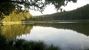
Thanninger Weiher
| Thanninger Weiher | ||
|---|---|---|

|
||
| Thanninger Weiher | ||
| Geographical location | Bavaria , Germany | |
| Tributaries | Moosbach | |
| Drain | Moosbach → Isar → Danube → Black Sea | |
| Location close to the shore | Egling | |
| Data | ||
| Coordinates | 47 ° 55 '14 " N , 11 ° 33' 31" E | |
|
|
||
| Altitude above sea level | 646 m and 647 m | |
| Maximum depth | 3 m | |
| Middle deep | 2 m | |
|
particularities |
3 ponds (1, 2 and 3) |
|
Thanninger Weiher refers to three artificial lakes near Thanning bei Egling .
The Moosbach is dammed in the Thanninger Weihern . The ponds were created at the beginning of the 18th century by the abbot of Schäftlarn monastery for fish farming.
The lakes are privately owned. Bathing is not officially permitted, but is tolerated on the first lake accessible from the road.
The lakes are stocked with carp , tench , pike , pikeperch , European eel , several species of white fish and trout .
Web links
Commons : Thanninger Weiher - Collection of images, videos and audio files
