Thanon Phra Ruang
The Thanon Phra Ruang ( Thai ถนน พระร่วง , English Phra Ruang Road , German: "Straße des Phra Ruang ") is the archaeological finding of the route of an earthworks in central and northern Thailand , which in the Sukhothai period the ancient cities of Si Satchanalai , Sukhothai and Kamphaeng Phet connected. Research has not yet finally clarified whether this route is actually a former road or whether it could have been a khlong ( Thai คลอง , German: canal).
The Thanon Phra Ruang leads from Si Satchanalai (old town), located on Mae Nam Yom , over a length of 120 kilometers in a southerly direction, first to Sukhothai (old town), and from there on to Kamphaeng Phet on Mae Nam Ping . In the middle of the first section of the route, it touches the area around Wat Yai Chai Mongkhon and Wat Bot , two Buddhist temples from the early Sukhothai period northwest of Mueang Bang Khlang , which plays a certain role in the founding myth of the Sukhothai Kingdom .
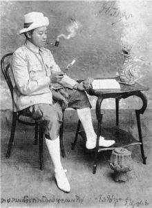
In 1907, Crown Prince Vajiravudh (the later (1910–1926) King Rama VI.) Traveled on the back of an elephant to the earthwork, which was clearly perceptible in the area at that time, and named it "Thanon Phra Ruang". Today only sections of a dam body with an adjacent moat can be seen in the area. In the northern section, large sections of the route were cut during the construction of the modern connecting road 1113 and thus destroyed. The widths of the remaining findings averaged eight meters, with a partial maximum of up to twelve meters.
In the early 1990s, an international team of geologists from Chulalongkorn University ( Bangkok ) and Monash University ( Melbourne ) examined the Thanon Phra Ruang, evaluating aerial and satellite images, analyzing geographical conditions and carrying out a six-week field survey. The team then hypothesized that the route was not an old road link, but an irrigation canal for the adjacent rice fields. They also postulated that the earthworks had been built before the founding of the Sukhothai Kingdom as part of an early settlement phase. These theories were controversial but did not find wide acceptance.
Archaeological findings that could verify or falsify either the conventional definition of a street or the more recent canal theory are still pending.
literature
- Dawn F. Rooney : Ancient Sukhothai. Thailand's Cultural Heritage . River Books, Bangkok 2008, ISBN 978-974-9863-42-8 , pp. 6 and 22f.
- David Godley, Paul Bishop, Thiva Supajanya: Recent Data on Thanon Phra Ruang between Sukhothai and Si Satchanalai. Road or Canal? . The Journal of the Siam Society Vol. 81, Pt. 2 (1993), ISSN 0857-7099 , pp. 98-109.
Individual evidence
- ↑ Wat Yai Chai Mongkhon: 17 ° 15 '34.05 " N , 99 ° 40' 37.05" O
- ↑ Wat Bot: 17 ° 14 ′ 14.9 ″ N , 99 ° 40 ′ 25.3 ″ E
- ^ Dawn F. Rooney: Ancient Sukhothai. Thailand's Cultural Heritage . River Books, Bangkok 2008, ISBN 978-974-9863-42-8 , p. 22.
- ↑ The diaries of this trip were published in 1908 as "Journey into the Land of Phra Ruang" in Thai.
- ^ A b David Godley, Paul Bishop, Thiva Supajanya: Recent Data on Thanon Phra Ruang between Sukhothai and Si Satchanalai. Road or Canal? . The Journal of the Siam Society Vol. 81, Pt. 2 (1993), ISSN 0857-7099 , pp. 98-109.
- ^ Dawn F. Rooney: Ancient Sukhothai. Thailand's Cultural Heritage . River Books, Bangkok 2008, ISBN 978-974-9863-42-8 , p. 23.
