Thornton (Fife)
| Thornton | ||
|---|---|---|
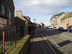
| Thornton Main Street | ||
| Coordinates | 56 ° 10 ′ N , 3 ° 9 ′ W | |
|
|
||
| Residents | 2016 census 2011 | |
| administration | ||
| Post town | KIRKCALDY | |
| ZIP code section | KY1 | |
| prefix | 01592 | |
| Part of the country | Scotland | |
| Council area | Fife | |
| British Parliament | Glenrothes | |
| Scottish Parliament | Mid Fife and Glenrothes | |
Thornton is a town in the Scottish Council Area Fife . It is located between the towns of Kirkcaldy in the south and Glenrothes in the north, between the Ore and Lochty Burn, a few kilometers away .
history
Thornton developed as a way station along a carriage route. As in the surrounding towns, coal was mined in Thornton. In the course of the 19th century, Thornton gained importance with the establishment of a freight yard as a hub for coal railways. In 1881 the village had 552 inhabitants. One impulse in the declining coal mining area of Fifes was the opening of the Rothes Pit by Queen Elisabeth in 1957 . Due to unexpected geological problems and water ingress, the mine was closed five years after opening, which is considered a political fiasco. There is a golf course on the eastern edge of Thornton.
After 2455 inhabitants were counted in Thornton in 1951, the trend is declining. In the 2011 census survey, people lived in Thornton in 2016.
traffic
The A92 ( Dunfermline - Stonehaven ) passes Thornton on the east flank. The North British Railway station was closed in 1969. In 1992, however, the new combined station Thornton with Glenrothes opened .
Individual evidence
- ↑ a b c Entry in the Gazetteer for Scotland
- ^ Information in the Gazetteer for Scotland
- ↑ 2011 census
- ↑ Thornton in: FH Groome (ed.): Ordnance Gazetteer of Scotland: A Survey of Scottish Topography, Statistical, Biographical and Historical , Grange Publishing Works, Edinburgh, 1882-1885.

