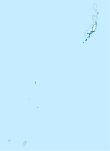
Toachel Mid
| Toachel Mid | ||
|---|---|---|
| Connects waters | Komebail Lagoon | |
| with water | Pacific Ocean | |
| Separates land mass | Babeldaob | |
| of land mass | Koror | |
| Data | ||
| Geographical location | 7 ° 20 '47 " N , 134 ° 31' 1" E | |
|
|
||
| Islands | Ngeream , Garreru , Ngedert , Omelochel , Ullemetamel , Itelblong , Ordachel | |
| bridges | Japan Palau Friendship Bridge | |
Toachel Mid (also: Armitjttoakl , Arumizu , Taogil Mid Passage , Toachel er Ngermid , Toagel Mid , Toagil Mid Passage , Koror-Babeldaob Channel ) is a channel in the island state of Palau that separates the two main islands of Babeldaob and Koror .
Names
Due to its colonial history , the canal has numerous other names: Ogurutaageru Passage , Ogurutageru Durchfahrt (German), Ogurutageru-suidō Japanese , Pipiroi Inlet .
geography
The canal begins in the west in the Komebail Lagoon , where the Japan-Palau Friendship Bridge connects the two islands and specifically the settlements of Ngetkib Hamlet and Ngerbodel Hamlet . It moves to the southeast, where it widens to a small lagoon east of Koror and then continues south. The islets of Ngeream , Garreru , Ngedert , Omelochel on the northeast side ( Airai ), as well as Ullemetamel , Itelblong , Ordachel on the west side ( Rock Islands ) together with the adjacent reefs ( Omekang Barrier Reef ) form the boundary in the south of the channel. In the south, the Uchelbeluu Barrier Reef shields the channel from the open sea.
Individual evidence
literature
- Republic of Palau Adventure and Dive Guide. Guide to the undisputed Best Diving in the World. Franko Maps Ltd. 2016.
