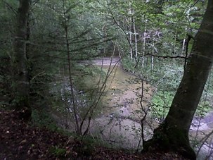
Tobelweiher (mountain)
| Tobelweiher | ||
|---|---|---|

|
||
| Geographical location | Guntershausen bei Berg , Weinfelden District , Canton Thurgau , Switzerland | |
| Tributaries | Tobelbach | |
| Drain | Tobelbach → Wisebach → Giessen → Thur | |
| Data | ||
| Coordinates | 731 851 / 270944 | |
|
|
||
| Altitude above sea level | 505 m | |
| length | approx. 30 m | |
| width | approx. 20 m | |
The Tobelweiher is a pond in the village of Guntershausen bei Berg , a district of the municipality of Berg in the canton of Thurgau in Switzerland .
location
Since a border adjustment between the municipalities of Berg and Birwinken in 2008, the pond has been entirely within the territory of the municipality of Berg. Before that, the municipal boundary went through the pond.
The Tobelbach flows into the Tobelweiher and leaves it again with this name.
use
The water is adjacent to a hiking trail. It is not suitable for bathing. The lake is fished, the hunting and fishing administration of the canton of Thurgau leases the fishing rights in the Tobelweiher.
Individual evidence
- ↑ Seven hectares for mountain , article in the St. Galler Tagblatt from June 12, 2008
- ^ Border adjustment with Birwinken , article on polizeinews.ch of March 26, 2008, accessed on April 25, 2013
- ↑ New tender for the fish lease in Tobelweiher, Gunterhausen (PDF; 3.9 MB) , notification in the communal bulletin of the Berg community, Volume 28, No. 123, October 2009, p. 4

