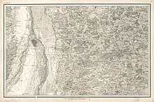
Topographical Atlas of the Kingdom of Bavaria
The Topographical Atlas of the Kingdom of Bavaria is a map that was edited by the Topographical Bureau of the Royal Bavarian General Staff since 1812 and published in 1867.
It contains the title, an overview with an explanation of symbols and 112 map sheets of the Kingdom of Bavaria including the Palatinate on a scale of 1: 50,000. The map sheets are made as copper engravings . Each sheet represents an area 40 km wide in the Bonnean projection . Terrain forms were represented by hatching .
It was created on the basis of the main triangular network points measured again by Johann Georg von Soldner in 1808 . The atlas used the Bavarian prime meridian of the Bogenhausen observatory , with the difference in length to the ferro meridian being given. First of all, island-shaped surveys of Munich and Wolfratshausen on a scale of 1: 28,000 were used as engravings. From 1817 onwards, scaled-down cadastral maps were used. In 1867 the complete set of maps was available.
At the world exhibition in London in 1862 it was awarded a gold medal.
In the period that followed, the continuously updated map sheets formed the basis for the Bavarian part of the map of the German Empire (General Staff Map) on a scale of 1: 100,000. The content and type of presentation of the atlas sheets then adapted to the requirements of the time. It was not until the mid-1950s that they were replaced by the modern topographic map 1: 50,000 (TK50) .
See also
Web links
- Herbert Zwerenz: From Topographical Atlas to BavariaAtlas - 200 years of official topographical map 1:50,000. In: Mitteilungen 2013 , Issue 1, DVW eV Society for Geodesy, Geoinformation and Land Management, pp. 21–44
- Topographic atlas 1: 50,000 on ldbv.bayern.de
Individual evidence
- ^ A b Hans Wolff: Bavaria in the picture of the map - Carthographia Bavariae . Ed .: Bayerische Staatsbibliothek. 2nd Edition. Anton H. Konrad Verlag, Weißenhorn 1991, ISBN 3-87437-301-0 , p. 225 .
- ↑ The Greenwich Meridian was first established at the International Meridian Conference in 1884.
- ↑ Zwerenz, p. 28
- ↑ Zwerenz, pp. 21, 22
