Torbay (Western Australia)
| Torbay | |||||||
|---|---|---|---|---|---|---|---|
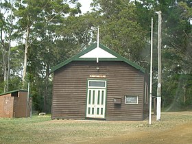
 Torbay Hall |
|||||||
|
|||||||
|
|||||||
|
|||||||
|
|||||||
|
|
|||||||
Torbay is a small town in the Australian state of Western Australia . It is located about 22 kilometers from Albany and about 28 kilometers from Denmark . The place is located in the traditional settlement area of the Aboriginal tribe of the Mineng .
geography
Torbay is located on the South Coast Highway west of Albany and is part of the LGA City of Albany . In the west, the scattered settlement borders on Youngs Siding , in the east on Marbelup and Elleker , in the south on Kronkup and in the north on Redmond and Redmond West .
In the south, Torbay has about three kilometers of coastline on the Great Australian Bight , which consists almost entirely of beach. Torbay's two beaches are called Perkins Beach and Port Hughes .
Torbay also includes Wilgie Hill , Unndiup Creek, and Torbay Inlet .
population
Bornholm had a population of 320 people in 2016, 52.4% male and 47.6% female. There are no Aborigines or Torres Strait Islanders among them .
The average age in Bornholm is 49 years, 11 years more than the Australian average of 38 years.
Web links
Individual evidence
- ^ Australian Bureau of Statistics : Torbay ( English ) In: 2016 Census QuickStats . June 27, 2017. Retrieved July 16, 2019.
