Trayamar
Coordinates: 36 ° 44 '55 " N , 4 ° 2' 57" W.
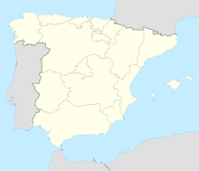
Trayamar is the Phoenician burial ground of the neighboring settlement of Morro de Mezquitilla. It is located near the mouth of the Rio Algarrobo in the province of Málaga in Spain . The coastal road E15 crosses the Rio Algarrobo at Algarrobo Costa 37 km east of Málaga . The poorly preserved settlement is to the east, the better preserved necropolis is west of the river. The sepulcral monuments of Trayamar are the usual ones in the western Mediterranean, but they are among the better explored.
Historical background
The Phoenician coastal settlements east of Málaga are well explored. Offices on the coast: Adra - Almuñecar - Benalmadena (unpublished) - Cabezo de San Pedro - Cabezo de la Esperanza - Castillo de Doña Blanca - Cerro Alarcón - Cerro del Peñón - Cerro del Mar - Cerro del Prado - Cerro del Villar - Cerro Doblas - Chorreras - El Saladillo Alto - La Loma - Malaka - Morro de Mezquitilla (near Trayamar) - Suel and Toscanos.
Well-known necropolis on the coast: Cortijo de las Sombras - Jardín - Las Cumbres - La Joya - Laurita - Tortuga and Trayamar.
The ceramic material largely corresponds to the chronology of the 8th century BC. Chr .; some pieces are even older. Alberto Lòpez Malax-Echeverria, when analyzing the settlements and necropolises, comes to the conclusion that trade and colonization were not the primary goals of the Phoenicians in Spain. Rather, as with the colonization of southern Italy by the Greeks, the focus here is on migration . Possibly also in contrast to the settlement that took place in the triangle between Ibiza , Corsica and Sicily . In southern Spain he especially misses the proximity to ore deposits, as well as Tephatim and weapons finds.
The Phoenician colonization begins (apart from Gadir - Spanish Cádiz ) in the 8th century BC. The starting point is the Phoenician city of Tire . Almost simultaneously, numerous colonies were founded in the western Mediterranean, including Carthage . Practically all archaeological sites with types of ceramics that were made on the potter's wheel join this colonization.
The necropolis
The rectangular chambers made from large machined blocks were placed in the mound. You have large entrances at the front. Finds that have provided evidence of chronology have been made in each tomb. Only one of the five graves has remained intact and can be viewed. Two were destroyed while the road was being built in 1965, two are poorly preserved. Both burials and cremations are verifiable. The latter were deposited in alabaster vessels.
- Grave no. 1 can be dated to around 650 BC. BC, but it also contains a secondary burial 150 years younger.
- The construction of graves 2 and 4 (examined before destruction) can be traced back to around 600 BC. And seems to mark the end of the burial period. The later use of the chambers for burials can either have occurred immediately or later and lasted until the settlement on the other bank was abandoned. The finds are exhibited in the Museo de Málaga.
The settlement
Traces of a Phoenician manufactory were discovered on the Morro de Mezquitilla in 1964 and excavated in 1967. As the successor to Neolithic and Bronze Age settlement on this hill, the Phoenician settlement was founded around the middle of the 7th century and was inhabited for around 200 years. Traces of a subsequent Roman era can also be found here .
literature
- Hans Georg Niemeyer , Hermanfrid Schubart : Trayamar. The Phoenician chamber tombs and the settlement at the Algarrobo estuary (Madrid contributions; Vol. 4). Verlag von Zabern, Mainz 1975.
