Tremmelberg
| Tremmelberg | ||
|---|---|---|
|
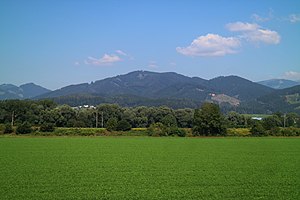
Tremmelberg from the southeast |
||
| height | 1194 m above sea level A. | |
| location | Styria ( Austria ) | |
| Mountains | Seckau Alps | |
| Dominance | 3.08 km → Adlerkuppe | |
| Notch height | 303 m ↓ Hackner | |
| Coordinates | 47 ° 14 '46 " N , 14 ° 47' 16" E | |
|
|
||
| rock | Orthogneiss , amphibolite , mica schist | |
The Tremmelberg with a height of 1194 m above sea level. A. is located in the Seckau Alps north of the Upper Styrian town of Knittelfeld .
The mountain is the easternmost branch of the Gaal mountain range , somewhat free from it by the lower Ingeringbach . It delimits the municipality of Seckaus from the Aichfeld . Its eastern foot extends to Kobenz .
In the first third of the 18th century a way of the cross with wayside shrines and the Kalvarienbergkirche were built on the Tremmelberg .
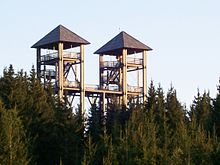
For the 1999 Styrian state exhibition on the subject of traffic , the Tower Power observation tower with an alpine path was built on the Tremmelberg, based on the twin towers of Seckau Abbey . A forest museum with an educational forest trail was also set up.


