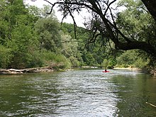
Trumpet Valley
As Trompetental - also Trompetentälchen - is in the geomorphology a funnel-shaped, glaziofluviatiles valley called, which is multi-phase by erosion into a gravel plain has cut. The creation of trumpet valleys was first described by Carl Troll in 1926. During the melting of the glaciers and the associated retreat from the main marginal area, ice reservoirs formed between the glacier front and the terminal moraine . The meltwater of the ice reservoirs broke locally through the terminal moraine layers and, as a result of increased deep erosion in the older gravel terraces, initially gradually broadened outwards (trumpet-shaped) in narrow channels. The corresponding gravel terrace and terminal moraine can be assigned to each retreat process. The younger gravel plains cut in terraces into the gravel areas that were formed earlier, deepening the valley shape, which is characterized by a wide valley floor .
Trumpet valleys are often found in the area of the Pleistocene foreland glaciation in the northern Alpine foreland . Characteristic examples of such glaciofluviatile valley shapes are the Trompetentälchen on the Ziegelberg near Bad Grönenbach , the Isar Valley when it breaches through the Worm Period terminal moraines south of Munich , the Würmtal , the Amperschlucht between Grafrath and Schöngeising and the Upper Gurktal .
Individual evidence
- ↑ Carl Troll: The young glacial gravel corridors around the German Alps . Research on German regional and folklore studies, Volume 24 (4), pp. 158–256.
- ^ Ulrich Lagally, Stefan Glaser, Elisabeth Jobe, Georg Loth, Andreas Murr, Hubert Schmid, Wolfgang Schmid, Klaus Schwerd, Stephan Sieblitz and Ulrich Teipe: Geotope in Schwaben . Earth science contributions to nature conservation, Volume 7, Augsburg 2009, ISBN 978-3-936385-34-2 , pp. 98f.
- ↑ lfu.bayern.de Geotop Trompetentälchen NE von Ziegelberg , accessed on October 30, 2015
- ↑ lfu.bayern.de Geotop Amperschlucht between Grafrath and Schöngeising , accessed on October 30, 2015.
- ↑ Harald Eicher: On the function of the Würm high levels in the area of the upper Gurktalung including the interface Gurk-Draugletscher , communications Austrian geological society, Volume 69, Vienna 1978, pp. 231–245.
literature
- Collective of authors: Lexicon of Geosciences , Volume V, Spektrum Akademischer Verlag, Heidelberg, Berlin 2002, ISBN 3-8274-0424-X , p. 252.

