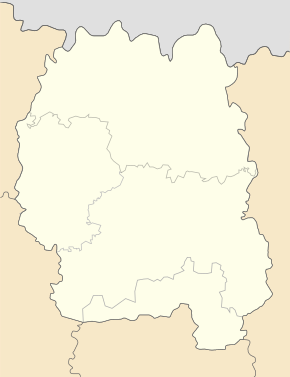
Tryhirja
| Tryhirja | ||
| Тригір'я | ||

|
|
|
| Basic data | ||
|---|---|---|
| Oblast : | Zhytomyr Oblast | |
| Rajon : | Zhytomyr district | |
| Height : | 231 m | |
| Area : | 0.588 km² | |
| Residents : | 172 (2001) | |
| Population density : | 293 inhabitants per km² | |
| Postcodes : | 12422 | |
| Area code : | +380 412 | |
| Geographic location : | 50 ° 12 ' N , 28 ° 22' E | |
| KOATUU : | 1822080604 | |
| Administrative structure : | 1 village | |
| Address: | вул. Шевченка буд. 25 12420 с. Тетерівка |
|
| Website : | Website of the Teterivka Rural Municipality | |
| Statistical information | ||
|
|
||
Tryhirja ( Ukrainian Тригір'я ; Russian Тригорье Trigorje ) is a village in the south of the Ukrainian Oblast Zhytomyr with about 170 inhabitants (2001).
The village belongs administratively to the rural community of Teterivka within the Zhytomyr Raion and is located at an altitude of 231 m on the right bank of the Teteriv , a 365 km long right tributary of the Dnieper , 8 km west of the district and oblast center of Zhytomyr . The N 03 road runs north of Tryhirja .
The Monastery of the Transfiguration of the Holy Spirit (official name: Monastery of the Holy Transfiguration of the Diocese of Zhytomyr of the Ukrainian Orthodox Church ) is located on the bank of the Teteriv .
Web links
Commons : Tryhirja - collection of images, videos and audio files
- Tryhurya, Tryhory . In: Filip Sulimierski, Władysław Walewski (eds.): Słownik geograficzny Królestwa Polskiego i innych krajów słowiańskich . tape 12 : Szlurpkiszki – Warłynka . Walewskiego, Warsaw 1892, p. 529 (Polish, edu.pl ).
- Website of the monastery on the official website of the Teterivka rural community (Ukrainian)
- Village and monastery website at travelua.com.ua (Ukrainian)
Individual evidence
- ^ Structure of the municipality on the official website of the rural municipality Teteriwka; accessed on July 24, 2019 (Ukrainian)
- ↑ Преображенський Тригірський чоловічий монастир ; accessed on July 24, 2019 (Ukrainian)
- ↑ Website of the monastery ; accessed on July 24, 2019 (Ukrainian)


