Tully Mountain
| Tully Mountain | ||
|---|---|---|
|
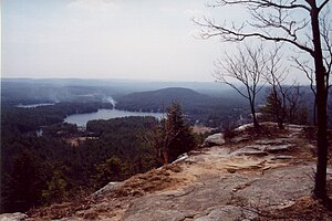
View from the top of the area |
||
| height | 351 m | |
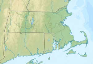
| location | Orange , Massachusetts , United States | |
| Coordinates | 42 ° 38 '52 " N , 72 ° 15' 0" W | |
|
|
||
| Type | Inselberg | |
| Age of the rock | 400 million years | |
The Tully Mountain is a 1,152 ft (351.1 m ) high island mountain in the city of Orange in the State of Massachusetts of the United States . It is located within the 1,187 acres (4.8 km² ) Tully Mountain Wildlife Management Area .
The mountain rises clearly from the surrounding flat landscape. It was formed 400 million years ago together with the northern Appalachians and brought into its present form during the last ice age by the retreating glaciers . This can be seen in particular from the fact that the mountain is rather smooth and level on its north side, while there is a lot of rubble on its south side and the ground is much less regular. A circular route about 1.5 mi (2.4 km ) long is part of the Tully Trail and leads to outcrops in the area of the summit, from which there is a good overview of the area.
The mountain drains over the Tully River and Millers River into the Connecticut River , which eventually flows into the Long Island Sound .
Individual evidence
- ^ Tully Mountain. (No longer available online.) North Quabbin Community Coalition, archived from the original on Aug. 9, 2013 ; accessed on June 24, 2014 . Info: The archive link was inserted automatically and has not yet been checked. Please check the original and archive link according to the instructions and then remove this notice.
Web links
- Tully Mountain in the United States Geological Survey's Geographic Names Information System
- Tully Mountain Wildlife Management Area. ( PDF ) Commonwealth of Massachusetts, Division of Fisheries and Wildlife, September 17, 2013, accessed June 24, 2014 (English, map of the area).

