
Uea (island)
| Uea | ||
|---|---|---|
 |
||
| Waters | Pacific Ocean | |
| Archipelago | Rotuma Islands | |
| Geographical location | 12 ° 27 '57 " S , 176 ° 59' 29" E | |
|
||
| length | 1.1 km | |
| width | 800 m | |
| surface | 73 ha | |
| Highest elevation | Mount Sarafui 262 m |
|
| Residents | uninhabited | |
| main place | Uea (historical) | |

Uea is the second largest of the Rotuma Islands in the central Pacific Ocean , after the much larger main island of Rotuma . Politically, it belongs to the special administrative area of Rotuma of the island state of Fiji , and includes its northernmost land mass. It belongs to the Ho'aga Keua, part of the village of Lopo in the Itu'muta district .
geography
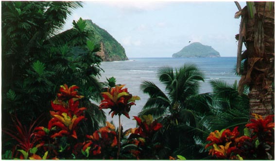
The island is located around 3 km northwest of the Ituʻmuta peninsula of Rotuma , the main island of the archipelago. It lies almost exactly on the 177th longitude east. Uea is 1.1 km long, up to 800 m wide and has an area of 73 ha (0.73 km²). The hilly island, characterized by steep coastal cliffs , is of volcanic origin and reaches a height of 262 m above sea level in Mount Sarafui in the western part of the island. The island, which is now uninhabited, was permanently inhabited by Polynesians until the 1930s . The village of the same name was in the east of the island. Uea is still occasionally used to harvest coconuts .
fauna
The densely forested island is an important refuge for the crimson honey-eater ( Myzomela chermesina ), which is endemic to the Rotuma Islands and whose population is endangered .
Web links
Individual evidence
- ↑ [1]
- ↑ a b rotuma.net Ecology and Early History, p. 5 (PDF; English; 1.8 MB)
- ↑ Sailing Directions (enroute), Pub. 126, Pacific Ocean (PDF; English; 5.1 MB)
- ↑ BirdLife International (2011) Species factsheet: Myzomela chermesina (English)