
Rotuma (Fiji)
| Rotuma | |
|---|---|

|
|
| geography | |
| Country: | Fiji |
| Waters: | Pacific Ocean |
| Islands: | 14th |
| Geographical location: | 12 ° 30 ′ S , 177 ° 5 ′ E |
| Basic data | |
| Surface: | 46 km² |
| Residents: | 1583 |
| Population density: | 34 inhabitants / km² |
| Capital: | Ahau |
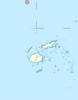
| Situation map | |
  |
|
Rotuma is a special administrative district ( dependency ) alongside the four divisions of the Republic of Fiji .
geography
The archipelago is 646 km (as the crow flies from Suva to Ahau ) north of the actual Fiji Islands. In addition to the main island of the same name, Rotuma , which is the only one inhabited, there are some islands within the fringing reef of the main island (e.g. Solkope and Solnohu in the south), as well as an island chain five kilometers west of the main island, which extends from Uea in the northeast via Hatana extends to Hạf Liua in the southwest.
The main island is 13 km long and 4 km wide. It is divided into a larger eastern part and a smaller western peninsula by a low isthmus only 230 meters wide . The village of Motusa is located on the isthmus . To the north is Maka Bay, and to the south is Hopmafau Bay. These bays are rich in coral reefs through which boat passages lead.
The area is 46 km² (of which the main island 43 km²).
Demographics
The island is mainly populated by the Rotumans , besides by Fijians (iTaukei) and Samoans. As a result of internal migration, however, only a minority of the Rotumans still live on Rotuma, while 9984 live on the actual Fiji Islands (2007 census).
According to the 2007 census , Rotuma had a population of 2002, including 1953 Rotuma. According to statistical data, the population has decreased by about a third since the mid-1960s. In 2017, a total of 1,594 people lived in the district.
The capital is Ahau . The official language is Rotuman .
Although Rotuma has been part of Melanesian Fiji politically since 1881, the Rotuma culture is more similar to the Polynesian culture in the east, especially that of Tonga , Samoa and Wallis and Futuna .
Traditional regional breakdown
Rotuma is divided into seven traditional autonomous districts, each headed by a chief ( Gagaj ʻes Ituʻu ).
According to tradition, there were originally five districts: Itu'ti'u, Fag'uta, Oinafa, Noa'tau and Malhaha. A district was divided twice. Tradition has it that part of the largest district, Itu'ti'u (the word meaning of Itu'ti'u is large district ), was given to a sub-chief of Oinafa, creating the Itu'muta district. Even after this division, Itu'ti'u is still the largest district in terms of area and population, while the separated Itu'muta district is the smallest in terms of both criteria. A second story describes a war in which the Fag'uta district was defeated by Oinafa and other districts. As a result, Fag'uta, the second largest district after Itu'ti'u, was divided into the Pepji and Juju districts in order to weaken the power of its chief. At the time of contact with Europeans (1791) there were therefore seven districts:

|
The district chiefs and the elected district representatives form the Rotuma Island Council . The districts are further subdivided into hoʻaga (groups of households), which form working groups under the direction of a sub-chief ( gagaj ʻes hoʻaga ) and which correspond to the 28 villages.
History and politics
The first European explorer is Captain Edward Edwards of the HMS Pandora , who sighted the island during the search for the mutineers of the Bounty in 1791. There was only a brief contact with the suspicious and war-ready residents, which ended in an exchange of gifts for provisions. In 1881 Rotuma was annexed to Great Britain . With Fiji's independence in 1970, Rotuma remained with Fiji, but as a special administrative district ( dependency ) it enjoys a certain internal autonomy.
For statistical purposes , such as the census, the government of Fiji treats Rotuma as a province of the Eastern Division , even though the area is in the extreme northwest .
Individual evidence
- ↑ Statistical information from statoids.com, viewed June 9, 2010 (English)
- ↑ Census 2017. (No longer available online.) In: statsfiji.gov.fj. Fiji Bureau of Statistics, March 5, 2018, archived from the original on February 12, 2018 ; accessed on March 23, 2018 (English).
- ^ John Stanley Gardiner (1898), "The Natives of Rotuma," Journal of the Royal Anthropological Institute 27: 428-431, here p. 428
- ↑ Alan Howardand and Jan Rensel: Iceland Legacy. History of the Rotuman People. Chapter 3: The Social Order, p. 74
- ↑ citypopulation.de: Fiji: Administrative Division
- ^ Rotuma Feasibility Studies
- ^ Fiji: Population and Census Surveys