Union City (Michigan)
| Union City | ||
|---|---|---|
|
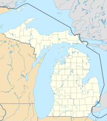
Location in Michigan
|
||
| Basic data | ||
| State : | United States | |
| State : | Michigan | |
| Counties : |
Branch County Calhoun County |
|
| Coordinates : | 42 ° 4 ′ N , 85 ° 8 ′ W | |
| Time zone : | Eastern ( UTC − 5 / −4 ) | |
| Residents : | 1,804 (as of: 2000) | |
| Population density : | 474.7 inhabitants per km 2 | |
| Area : | 3.8 km 2 (approx. 1 mi 2 ) of which 3.8 km 2 (approx. 1 mi 2 ) are land |
|
| Height : | 276 m | |
| Postal code : | 49094 | |
| Area code : | +1 517 | |
| FIPS : | 26-81360 | |
| GNIS ID : | 1615340 | |
| Website : | www.liveinuc.com | |
Union City is a village ( Village ) in Branch County in the US state of Michigan . The village is part of the Battle Creek, Michigan Metropolitan Statistical Area . The population was 1804 in 2000.
The village is in the Union Township , where the Coldwater River flows into the St. Joseph River . The M-60 Highway runs north of the village. A small part of the city is in Burlington Township in Calhoun County .
history
Meteor Ridge Farm, also known as The Plantation, was built in 1859 or 1860 (the exact year is not known). "The Plantation" served as a station on the Underground Railroad . Even President Lincoln had visited the village once.
Famous people in the village
- Josh McDowell (* 1939), evangelist, apologist and author
