St. Joseph River (Lake Michigan)
| St. Joseph River | ||
|
Course of the river and drainage basin of the St. Joseph River |
||
| Data | ||
| Water code | US : 1624891 | |
| location | Indiana , Michigan | |
| River system | Saint Lawrence River | |
| Drain over | St. Clair River → Detroit River → Niagara River → Saint Lawrence River → Atlantic Ocean | |
| Source lake |
Baw Beese Lake at Hillsdale 41 ° 54 ′ 18 ″ N , 84 ° 36 ′ 57 ″ W. |
|
| Source height | 334 m | |
| muzzle |
Lake Michigan coordinates: 42 ° 6 ′ 51 ″ N , 86 ° 29 ′ 18 ″ W 42 ° 6 ′ 51 ″ N , 86 ° 29 ′ 18 ″ W |
|
| Mouth height | 177 m | |
| Height difference | 157 m | |
| Bottom slope | 0.46 ‰ | |
| length | 338 km | |
| Catchment area | 12,133 km² | |
| Discharge at the Elkhart A Eo gauge: 8728 km² |
MQ 1948/2016 Mq 1948/2016 |
93 m³ / s 10.7 l / (s km²) |
| Left tributaries | Coldwater River | |
| Reservoirs flowed through | Union Lake, Twin Branch Dam, Mishawaka Dam, South Bend Dam, Niles Dam, Niles Dam, Buchanan Dam, Berrien Springs Dam | |
| Medium-sized cities | Elkhart , Mishawaka , South Bend | |
| Small towns | Hillsdale , St. Joseph , Three Rivers , Niles | |
| Communities | Union City | |
|
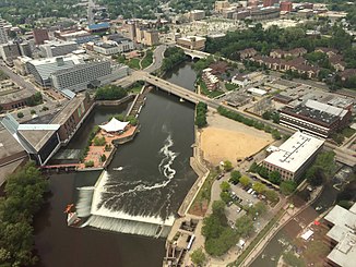
St. Joseph River in South Bend |
||
|
St. Joseph River near Mishawaka |
||
The St. Joseph River is a 338 km long tributary of Lake Michigan in the extreme southwest of the Lower Peninsula in the US states of Michigan and Indiana .
course
The river begins as an outflow of the small lake Baw Beese Lake in the small town of Hillsdale in Hillsdale County in the extreme south of Michigan. It initially flows to the northwest, later to the west. It passes Union City and Three Rivers , then turns southwest and crosses the border into Indiana. There are 67 kilometers of river in Indiana. The St. Joseph River turns west again and passes the towns of Elkhart , Mishawaka and South Bend . At South Bend the St. Joseph River turns north, crosses the border into Michigan, passes Niles and finally flows into Lake Michigan at St. Joseph .
nature and environment
Fish ladders have been built at the dams on the lower reaches of the St. Joseph River since the 1990s . This allows the migratory fish to swim 100 kilometers upstream from the estuary to the Twin Branch Dam in Mishawaka .
Web links
Individual evidence
- ↑ Baw Beese Lake in the Geographic Names Information System of the United States Geological Survey
- ^ Saint Joseph River in the Geographic Names Information System of the United States Geological Survey
- ↑ a b St. Joseph River (South Bend) . Indiana Dept. of Natural Resources. Retrieved June 30, 2017.
- ↑ USGS 04101000 ST. JOSEPH RIVER AT ELKHART, IN
- ↑ a b Interstate Anadromous Fish Project . Michigan Dept. of Natural Resources. Retrieved June 30, 2017.


