Mishawaka
| Mishawaka | ||
|---|---|---|
| Nickname : The Princess City | ||
 Aerial view of downtown Mishawaka |
||
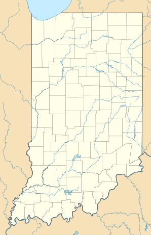
| Location in Indiana | ||
|
|
||
| Basic data | ||
| Foundation : | 1833 | |
| State : | United States | |
| State : | Indiana | |
| County : | St. Joseph County | |
| Coordinates : | 41 ° 40 ′ N , 86 ° 10 ′ W | |
| Time zone : | Eastern ( UTC − 5 / −4 ) | |
| Residents : | 48,679 (as of 2016) | |
| Population density : | 1,196 inhabitants per km 2 | |
| Area : | 41.6 km 2 (approx. 16 mi 2 ) of which 40.7 km 2 (approx. 16 mi 2 ) is land |
|
| Height : | 219 m | |
| Postcodes : | 46544-46546 | |
| Area code : | +1 574 | |
| FIPS : | 18-49932 | |
| GNIS ID : | 0452691 | |
| Website : | www.mishawakacity.com | |
| Mayor : | Jeffrey L. Rea | |
Mishawaka is a city in St. Joseph County in the US state of Indiana . The population at the last census in 2000 was 46,557.
geography
Mishawaka is at 41 ° 40 ′ 3 ″ (41.667498) north latitude and 86 ° 10 ′ 17 ″ (−86.171253) west longitude.
The total area of the city is 41.6 km². 2.12% of the area is water.
Population development
| year | Residents¹ |
|---|---|
| 1980 | 40,201 |
| 1990 | 42,608 |
| 2000 | 46,557 |
| 2005 | 48,497 |
¹ 1980–2000: census results; 2005: Update of the US Census Bureau
population
According to the 2000 census, there are 20,248 households and 11,642 families in Mishawaka, the population density is 1,144 people per km².
91.58% of the population are white, 3.56% African American, 2.79% Latinos, 0.43% Native American, 1.39% Asian and 2.04% of other origins.
Of the 20,248 households, 28.2% have children under the age of 18, 40.2% are married couples, 13.0% are single-parent families and 42.5% are non-families.
24.0% of the population is under 18 years old, 11.8% 18–24 years, 30.7% 25–44 years, 19.4% 45–64 years, 14.0% are 65 years and older. The average age is 34 years. For every 100 women there are 89.7 men.
sons and daughters of the town
- Allan "Rocky" Lane (1909–1973), actor
- Pete Candoli (1923-2008), jazz trumpeter
- John Brademas (1927-2016), politician
- Conte Candoli (1927-2001), jazz trumpeter
- Buddy Emmons (1937–2015), pedal steel guitar pioneer
- Lisa Germano (* 1958), singer, songwriter and violinist
- Kyle Bornheimer (* 1975), actor
- Adam Driver (born 1983), actor
