University Heights (Ohio)
| University Heights | ||
|---|---|---|
|
Location in Ohio
|
||
| Basic data | ||
| Foundation : | 1908 | |
| State : | United States | |
| State : | Ohio | |
| County : | Cuyahoga County | |
| Coordinates : | 41 ° 30 ′ N , 81 ° 32 ′ W | |
| Time zone : | Eastern ( UTC − 5 / −4 ) | |
| Residents : | 14,146 (as of: 2000) | |
| Population density : | 2,984.4 inhabitants per km 2 | |
| Area : | 4.74 km 2 (approx. 2 mi 2 ) of which 4.74 km 2 (approx. 2 mi 2 ) is land |
|
| Height : | 317 m | |
| Postal code : | 44118 | |
| Area code : | +1 216 | |
| FIPS : | 39-78932 | |
| GNIS ID : | 1086002 | |
| Website : | www.universityheights.com | |
| Mayor : | Beryl E. Rothschild | |
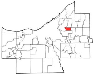
 University Heights in Cuyahoga County |
||
University Heights is a city in Cuyahoga County in the US state of Ohio . It is located about 13 kilometers east of Cleveland , is 4.74 km² and had 14,146 inhabitants (2000), of which 75.4% were white. University Heights is home to the Catholic John Carroll University , one of the three major universities in the Cleveland area.
The University Heights area was spun off from Warrensville Township in 1908 under the name Idlewood . The place got its current name in 1925 when John Caroll University moved its headquarters from Cleveland here. In 1940 University Heights was promoted to city.
The place was dominated by agriculture until the First World War. Then University Heights developed together with the surrounding suburbs of Cleveland into a residential community. The population grew from 500 (1925) to almost 6000 inhabitants (1940) and reached the current level by around 1960. The development is extensive and consists mainly of single houses of the middle class.
source
- UNIVERSITY HEIGHTS. In: Encyclopedia of Cleveland History. Case Western Reserve University, 2003, accessed March 3, 2010 .
