Hipkendahl
|
Hipkendahl
City of Wuppertal
Coordinates: 51 ° 13 ′ 40 ″ N , 7 ° 9 ′ 27 ″ E
|
||
|---|---|---|
| Height : | 275 m above sea level NHN | |
|
Location of Hipkendahl in Wuppertal |
||
|
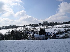
Hipkendahl in winter
|
||
Hipkendahl is a hamlet in the mountainous city of Wuppertal .
Location and description
The hamlet is located in the east of the Hahnerberg residential area in the Cronenberg district at an altitude of 275 m above sea level. NHN above the Gelpetals . To the west of the rural town, which is home to smaller businesses and riding stables, there is state road 418 , which passes under the densely built-up area of the same name in the Hahnerberger Tunnel .
Hahnerberger Strasse ( Landesstrasse 427) is also to the west . In the 19th century, this road was an important trade route between the Rhine and the then independent town of Elberfeld , the provincial road Elberfeld – Hitdorf .
The Hipkendahler Bach, a tributary of the Gelpe , has its source in the village.
history
The place emerged from a court that was already mentioned in the Elberfeld church roll of 1551. Other names are Hupkendahl and Hypkendahl . It is also recorded on the Topographia Ducatus Montani by Erich Philipp Ploennies from 1715. At that time Hipkendahl consisted of two separate living spaces , called o.Dahl ("Oberdahl") and n.Dahl ("Niederdahl"). In 1815/16 there were 164 inhabitants. On the topographical survey of the Rhineland , the farms in 1824 Ob. Hipkenthal and Unt. Called Hipkenthal . The Obere Hipkendahl farm was north of Landesstraße 418 and was demolished around 1970 before the motorway-like expressway was built.
In 1832 Hipkendahl belonged to the Hahn und Hipkendahler Rotte of the rural outskirts of the parish and the city of Elberfeld . The place, categorized as a hamlet according to the statistics and topography of the Düsseldorf administrative district , was designated as Im Hipkendahl and at that time had nine residential buildings and seven agricultural buildings. At that time, 101 people lived in the place, two of them Catholic and 99 Protestant. In 1888, eleven houses with 103 inhabitants are listed in the community encyclopedia of the Rhine Province .
The southern part of the nature and environment station , an environmental educational facility of the city of Wuppertal, today takes up a large part of the area of Ob. Hipkendahl a. Today only the residential area Unt. Hipkendahl referred to as Hipkendahl.
Individual evidence
- ^ Wolfgang Stock: Wuppertal street names . Thales Verlag, Essen-Werden 2002, ISBN 3-88908-481-8
- ↑ a b Johann Georg von Viebahn : Statistics and Topography of the Administrative District of Düsseldorf , 1836
- ↑ Königliches Statistisches Bureau (Prussia) (Ed.): Community encyclopedia for the Rhineland Province, based on the materials of the census of December 1, 1885 and other official sources, (Community encyclopedia for the Kingdom of Prussia, Volume XII), Berlin 1888.


