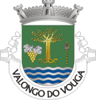
Valongo do Vouga
| Valongo do Vouga | ||||||
|---|---|---|---|---|---|---|
|
||||||
| Basic data | ||||||
| Region : | Centro | |||||
| Sub-region : | Aveiro Region | |||||
| District : | Aveiro | |||||
| Concelho : | Águeda | |||||
| Coordinates : | 40 ° 37 ′ N , 8 ° 27 ′ W | |||||
| Residents: | 4877 (as of June 30, 2011) | |||||
| Surface: | 43.2 km² (as of January 1, 2010) | |||||
| Population density : | 113 inhabitants per km² | |||||
| politics | ||||||
| Address of the municipal administration: | Junta de Freguesia de Valongo do Vouga Rua do Espírito Santo, Povoa do Espírito Santo |
|||||
| Website: | www.jf-valongodovouga.pt | |||||
Valongo do Vouga is a municipality ( freguesias ) in the Portuguese district of Águeda . In Valongo do Vouga there are 4877 inhabitants (as of June 30, 2011) on an area of 43.2 km².
history
The name "Valongo do Vouga" comes from the Latin "Vallum Longum", which means "long valley" in German.
Individual evidence
- ↑ www.ine.pt - indicator resident population by place of residence and sex; Decennial in the database of the Instituto Nacional de Estatística
- ↑ Overview of code assignments from Freguesias on epp.eurostat.ec.europa.eu
- ↑ History of Valongo do Vouga ( page no longer available , search in web archives ) Info: The link was automatically marked as defective. Please check the link according to the instructions and then remove this notice. - Retrieved April 7, 2012
Web links
- Map of the Freguesia Valongo do Vouga at the Instituto Geográfico do Exército
- http://www.valongodovouga.net


