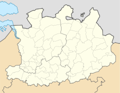
Vorst (Antwerp)
| Vorst | ||
|---|---|---|
|
|
||
| State : |
|
|
| Region : | Flanders | |
| Province : | Antwerp | |
| District : | Turnhout | |
| Municipality : | Laakdal | |
| Coordinates : | 51 ° 5 ' N , 5 ° 1' E | |
| Area : | 15.49 km² | |
| Inhabitants: (status) | 6,368 pop. ( 01/01/2006 ) | |
| Population density: | 411 inhabitants per km² | |
| Height: | 20 m | |
| Post Code: | 2430 | |
| Prefix: | (+32) 13, 14 | |
Vorst is a district of the Belgian municipality of Laakdal and is located in the Arrondissement of Turnhout in the province of Antwerp . Vorst was an independent municipality until the end of 1976. The village of Vorst, to which the hamlet of Meerlaar also belongs, extends over an area of 15.49 km² and on January 1, 2006 had 6368 inhabitants.
Attractions
- Construction of something located outside the center of St. Gertrudis Church ( NDL. "Sint-Gertrudiskerk") was begun in 1460, the associated tower later, in 1520, built, and the aisles were finally built in 1756.
- The rectory dates from 1690 and replaced an adobe building at the time. The attic of the rectory once served as a tithe barn . The whole is surrounded by a moat that was dug as early as 1639 and was mainly intended to offer protection from wandering soldiers.
- The old town hall was laid out at the beginning of the 20th century. It was designed by the architect Taeymans at the time and is now used as a police station.
nature and landscape
Vorst lies between the Grote Laak in the south and Kleine Laak in the north.
Between Vorst and the neighboring town of Eindhout there is a moist forest area along the Kleine Laak , in which there are some natural landscapes , such as B. Ossebroeken and Swinnebroeken ( German approximately: "Ochsenbruch" or "Schweinbruch" ).
Club life
- There are 2 football clubs in Vorst: Standaard Vorst and Excelsior Vorst.
Development of the population
19th century
| year | 1806 | 1816 | 1830 | 1846 | 1856 | 1866 | 1876 | 1880 | 1890 |
|---|---|---|---|---|---|---|---|---|---|
| population | 1,467 | 1,519 | 1,764 | 1,992 | 2,059 | 2.141 | 2,204 | 2,265 | 2,309 |
| Note: census results as of December 31 of the respective year | |||||||||
20th century until the municipal reorganization in 1976
| year | 1900 | 1910 | 1920 | 1930 | 1947 | 1961 | 1970 | 1976 | |
|---|---|---|---|---|---|---|---|---|---|
| population | 2,544 | 2,824 | 3,035 | 3,389 | 4,222 | 5.101 | 5,537 | 5,619 | |
| Note: census results (up to 1970) as of December 31st of the respective year | |||||||||
Town twinning
-
 Tönisvorst ( Germany )
The fact that the name was identical with the district of Vorst , which belongs to the German town of Tönisvorst , led to a town partnership between the "mother communities" of Laakdal and Tönisvorst a few years ago.
Neighboring places
| Westerlo | Eindhout | Zittaart |
| Veerle |

|
Klein Vorst |
| Averbode | Okselaar | Shot |
Individual evidence
- ^ Topographic map of Belgium 1: 100,000, sheet 106 (Dendermonde - Herentals), 1st edition published in 1988 by the National Geographic Institute, Brussels, Belgium
- ^ Topographical map of Belgium 1: 100,000, sheet 107 (Diest - Maaseik), 1st edition published in 1987 by the National Geographic Institute, Brussels, Belgium
