Vrapčište
| Vrapčište Врапчиште Vrapçishti / Vrapçisht |
||||
|---|---|---|---|---|
|
||||
| Basic data | ||||
| Region : | Polog | |||
| Municipality : | Vrapčište | |||
| Coordinates : | 41 ° 50 ′ N , 20 ° 53 ′ E | |||
| Height : | 580 m. i. J. | |||
| Residents : | 4,874 (2002) | |||
| Structure and administration | ||||
| Community type: | Opština | |||
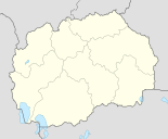
Vrapčište ( Macedonian Врапчиште ; Albanian Vrapçishti / Vrapçisht ; Turkish Vrapçişte ) is a village and administrative seat of the Opština of the same name (Alb. Komuna ) in north-western North Macedonia .
geography
Vrapčište is located on the western edge of the plain called Polog and is only a few kilometers from the town of Gostivar . To the west rises the up to 2000 meter high Šar Planina (alb. Sharr ), the eastern slope of which is completely forested above the village. To the east of Vrapčište are fertile fields.
The Vrapčište Opština has a population of 25,399, of which 21,101 were Albanians , 3,134 Turks , 1,041 Macedonians and 123 other ethnic groups . In addition to the actual village, there are 14 other localities in the Opština. The village alone has 4874 inhabitants.
traffic
The M4 motorway runs east of the village in a north-south direction, where Vrapčište has its own connection. The Macedonian Railways' non-electrified Skopje - Kičevo line runs parallel to the motorway .
Web links
Individual evidence
- ^ 2002 census. State Statistical Office, accessed on January 4, 2013 (English, PDF file, 384 KB).
- ↑ 2002 census (with all localities). State Statistical Office, accessed on January 4, 2013 (English, PDF file, 3.05 MB).

