Wałpusz (lake)
| Wałpusz | ||
|---|---|---|
| Geographical location | northeast of Szczytno , Poland | |
| Drain | Wałpusza | |
| Islands | 2 | |
| Places on the shore | Wałpusz , Stare Kiejkuty | |
| Location close to the shore | Szczytno | |
| Data | ||
| Coordinates | 53 ° 35 '56 " N , 21 ° 4' 18" E | |
|
|
||
| Altitude above sea level | 143.3-143.8 m | |
| surface | 371.0-436.9 ha | |
| length | 5.72 km | |
| width | 1.56 km | |
| volume | 18,146.9 m³ | |
| scope | 14,800 m | |
| Maximum depth | 10.3 m | |
| Middle deep | 4.2 m | |
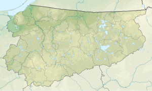
The Wałpusz ( German Waldpusch-See ) is a lake in the Warmian-Masurian Voivodeship in Poland , in historic East Prussia . On its western bank lies the village of the same name Wałpusz ( German Waldpusch ), in the northeast the place Stare Kiejkuty ( German Alt Keykuth ).
geography
The banks are rather flat and swampy in the broader southern part, and steeper in the narrower northern part. In an eastern bay, the Marksobski Channel flows from the Marksobsky Lake to the east, and in the north there is a connection from Lake Starokiejkuckie (Old Keykuther Lake). From the lake northeast of the town of Szczytno ( German Ortelsburg ), the 65.7 km long Wałpusza (Waldpusch) river flows south . There are two islands in the lake with an area of 1.8 hectares.
The state road 58 leads around the northern shore of the lake.
history
The lake was first mentioned around 1420. At that time the lake was called Alpus , also Walpus. The name has its roots in the Old Prussian language and can be interpreted as "young, fresh" when the Hittite , Lithuanian and Latvian languages are included. In German , a "d" was inserted through a reinterpretation to "Wald".
The lake was part of the outer fortification lines of the fortress Boyen in Lötzen and the location of an infantry factory .
In 1912 there were plans for an east canal , which was to connect the Vistula with the Masurian Lakes as an economic canal . A route would have included the Waldpusch lake.
The lake and its banks have been a quiet zone since 2003.
literature
- Fritz Herrgeist: The water, soil and dyke associations in East and West Prussia 1868 to 1938: Appendix: Melioration cooperatives in the Prussian province of Posen 1851 to 1918 , Quelle & Meyer 1983, ISBN 9783774564565
Footnotes
- ↑ a b c d Adam Choiński: Catalog jezior Polski . Poznań: Wydawnictwo Naukowe UAM, 2006, p. 393. ISBN 83-232-1732-7
- ↑ Georg Gerullis : The old Prussian place names collected and linguistically treated , Association of Scientific Publishers, 1922, p. 9 and 135
- ↑ Rozalia Przybytek: place names of Baltic origin in the southern part of East Prussia , Franz Steiner Verlag, 1993, ISBN 9783515064491 , p. 277
- ↑ Fortress plans of the War Ministry March 1910 , sheets 2 and 3, scale 1: 5000, in: Secret State Archives Preussischer Kulturbesitz , XI. HA, A 71382
- ↑ Paul Ehlers : The East Canal, an economic canal from the Vistula to the Masurian Lakes , 1912
