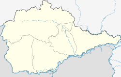
Waldheim (Jewish Autonomous Oblast)
| Village
Waldheim
Валдгейм
|
||||||||||||||||||||||||||
|
||||||||||||||||||||||||||
|
||||||||||||||||||||||||||
Waldheim ( Russian Валдгейм , Waldgeim ; Yiddish Waldhejm ) is a village (selo) in the Jewish Autonomous Oblast ( Russia ) with 1912 inhabitants (as of October 14, 2010).
The settlement is located about 15 kilometers south of the administrative center of the Oblast (also of the Rajons ) Birobidzhan on the left bank of the Bira . The village is the seat of a rural community of the same name (selskoje posselenige), which also includes four villages: Aeroport (13 km south-southeast; there is the small Birobidzhan-Yuzhny airfield, ICAO code UHHB ), Krasny Wostok (6 km south), Pronkino (9 km south) and Scholty Jar (15 km south-southeast).
Waldheim was the first Jewish settlement in the area. It was built on the instructions of the Soviet government in 1928 not far from the Tichonkaya regional center, which a few years later was renamed Birobidzhan. The settlers of Waldheim received the order to begin with the reclamation of the unused and hardly inhabited area.
Individual evidence
- ↑ a b Itogi Vserossijskoj perepisi naselenija 2010 goda. Tom 1. Čislennostʹ i razmeščenie naselenija (Results of the All-Russian Census 2010. Volume 1. Number and distribution of the population). Tables 5 , pp. 12-209; 11 , pp. 312–979 (download from the website of the Federal Service for State Statistics of the Russian Federation)

