Wall (South Dakota)
| Wall | |
|---|---|
 |
|
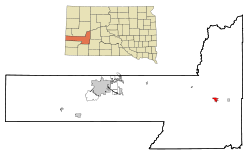
| Location in county and South Dakota | |
| Basic data | |
| Foundation : | 1908 |
| State : | United States |
| State : | South Dakota |
| County : | Pennington County |
| Coordinates : | 44 ° 0 ′ N , 102 ° 14 ′ W |
| Time zone : | Mountain ( UTC − 7 / −6 ) |
| Residents : | 766 (as of 2010) |
| Population density : | 136.8 inhabitants per km 2 |
| Area : | 5.7 km 2 (approx. 2 mi 2 ) of which 5.6 km 2 (approx. 2 mi 2 ) is land |
| Height : | 861 m |
| Postal code : | 57790 |
| Area code : | +1 605 |
| FIPS : | 46-68380 |
| GNIS ID : | 1262653 |
| Website : | www.wall-badlands.com |
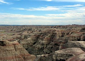
 Badlands National Park |
|
Wall ( Lakota : Makȟóšiča Aglágla Otȟuŋwahe ) is a town in Pennington County , South Dakota in the United States with over 750 inhabitants.
The place is about 10 km north of Badlands National Park on the division of US Highway 14 from Interstate 90 .
Web links
Commons : Wall (South Dakota) - Collection of pictures, videos, and audio files
