Wandflue
| Wandflue | ||
|---|---|---|
|
Grenchenberge with Wandflue |
||
| height | 1399 m above sea level M. | |
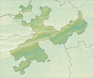
| location | Canton of Solothurn , Switzerland | |
| Mountains | law | |
| Dominance | 1.56 km → Stallflue | |
| Notch height | 46 m ↓ Obergrenchenberg | |
| Coordinates | 597 830 / 231310 | |
|
|
||
|
Wandflue seen from the south |
||
The Wandflue (often also written Wandfluh ) is a ridge in the mountains in the first Jura chain above Bettlach in the canton of Solothurn . The highest point is 1399 m above sea level. M. The ridge drops steeply to the southeast, at the top long and 50 meter high rock wall that is the symbol of Bettlach with a 2.5 kilometers. The wall extends to the municipality of Selzach above the mountain restaurant "Oberes Brüggli". Below this wall, the area is wooded, sloping to steep and almost inaccessible. Often there are also boulders or smaller cones of rubble between the pines and larches. They are evidence of more recent, minor crashes, but these are not worrying.
Emergence
The Wandflue was created by a landslide when the Rhone Glacier retreated at the end of the last Ice Age (between 12,000 and 10,000 BC) . As a result, the mountain flank no longer had a hold and slipped. Huge masses of rubble slid up to the Aare. Today the village of Bettlach is located on the slightly rising debris cone. The Bettlacher landslide is one of the larger landslides alongside the Flims landslide or the Goldau landslide .
Walks and passages
The Wandflue can be climbed at the following two locations without a rope or safety device. Both paths are only recommended for sure-footed, vertigo-free people.
- The first hiking trail is above the Bettlach. It begins above the Bettlachberg mountain restaurant and first zigzags through the forest and over rubble. Below the rock face begins a stone-carved, fortified staircase that leads between two offset rock faces directly onto the ridge. Only a few meters behind the ridge path next to the demolition site is a stone wall that marks the border between the two communities of Bettlach and Grenchen . The plateau behind the stone wall is called Obergrenchenberg. The pass road from Grenchen to Court is only 200 meters from the site (winter closure from Untergrenchenberg or Court, if there is snow).
- The second way to get to the Obergrenchenberg is above Selzach . The hiking trail, also known as the Küfferweg, begins on a mat to the west of the “Oberes Brüggli” restaurant. It first leads straight up the pasture and through a forest to the north. When you reach the rock face, a very narrow path begins, some of which you have to walk sideways. This leads up to the Fluh (about 200 meters in altitude).
Web links
- Current webcam from the Wandflue down to Bettlach
- Wandflue - wave surfing in the Jurassic Sea ( memento from October 13, 2011 in the Internet Archive ). Geological sights: glimpses into prehistoric times. Construction and Justice Department, Canton of Solothurn.
swell
- ^ Village history. Website of the community of Bettlach , accessed on March 16, 2013.


